Ðà Lạt night lights from space
Night Light of Ðà Lạt (Lâm Đồng) from space (Vietnam) Src. Average luminocity for 10x10km area is 76.8161% and for 50x50km: 10.1168%.
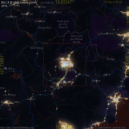
Analysis of Ðà Lạt night lights 2016
Square area 10x10 km:
 28.1%
28.1%90-99
21.07%80-89
6.82%70-79
13.22%60-69
5.58%50-59
3.51%40-49
7.85%30-39
3.72%20-29
7.23%10-19
2.89%0-9
0%Square area 50x50 km:
1.83%90-99
1.49%80-89
0.74%70-79
2.11%60-69
0.75%50-59
0.99%40-49
1.67%30-39
1.6%20-29
2.69%10-19
6.24%0-9
79.9%Clear (daylight) street map image can be seen on geolist.org.
Map coordinates:
12° 38' 0.5" North, 107° 44' 19.7" East
11° 56' 47.3" North, 108° 26' 30.9" East
11° 15' 27.8" North, 109° 8' 42.2" East
Some cities around Ðà Lạt sort by population:
• Nha Trang
88.3 km =54.9 mi,  67°
67°
• Đưc Trọng
24.6 km =15.3 mi,  197°
197°
• Bảo Lộc
82 km =51 mi,  237°
237°
• Buôn Ma Thuột
91.4 km =56.8 mi,  331°
331°
• Cam Ranh
78.1 km =48.5 mi,  92°
92°
• Phan Rang-Tháp Chàm
73.1 km =45.4 mi,  125°
125°
• Đinh Văn
28 km =17.4 mi,  230°
230°
• Gia Nghĩa
82 km =51 mi,  274°
274°
1584071 (p: 197,000)
Sources (retrieved 2019-11-25):
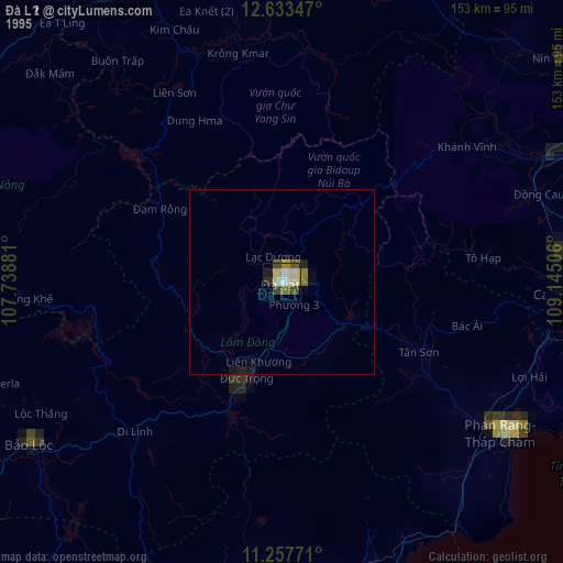
» NASA, Earths city lights 1995
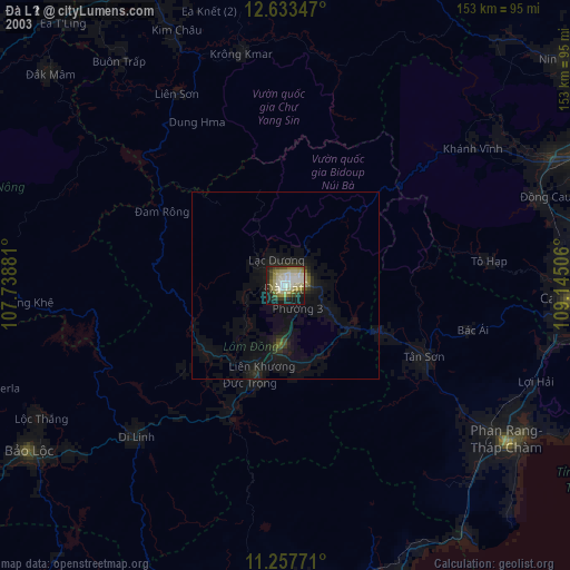
» NASA city lights 2003
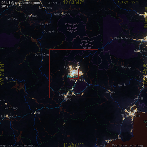
» Earth at Night: Flat Maps 2012, 2016