Güigüe night lights from space
Night Light of Güigüe (Carabobo) from space (Venezuela) Src. Average luminocity for 10x10km area is 25.0971% and for 50x50km: 25.5131%.
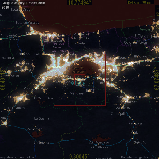
Analysis of Güigüe night lights 2016
Square area 10x10 km:
 0.41%
0.41%90-99
3.1%80-89
1.86%70-79
7.85%60-69
3.93%50-59
2.69%40-49
4.55%30-39
4.13%20-29
2.07%10-19
29.75%0-9
39.67%Square area 50x50 km:
6.11%90-99
5.61%80-89
1.28%70-79
3.7%60-69
3.59%50-59
2.98%40-49
2.92%30-39
3.86%20-29
5.52%10-19
9.96%0-9
54.48%Clear (daylight) street map image can be seen on geolist.org.
Map coordinates:
10° 46' 29.8" North, 68° 28' 52" West
10° 5' 0.4" North, 67° 46' 40.8" West
9° 23' 25.6" North, 67° 4' 29.5" West
Some cities around Güigüe sort by population:
• Maracay
26.5 km =16.5 mi,  50°
50°
• Valencia
26.6 km =16.5 mi,  289°
289°
• Guacara
19.2 km =11.9 mi,  325°
325°
• El Limón
29.4 km =18.3 mi,  32°
32°
• Palo Negro
27.7 km =17.2 mi,  68°
68°
• Mariara
24.5 km =15.2 mi,  15°
15°
• San Joaquín
19.8 km =12.3 mi,  355°
355°
• Tacarigua
15.5 km =9.6 mi,  271°
271°
3639747 (p: 71,530)
Sources (retrieved 2019-11-25):
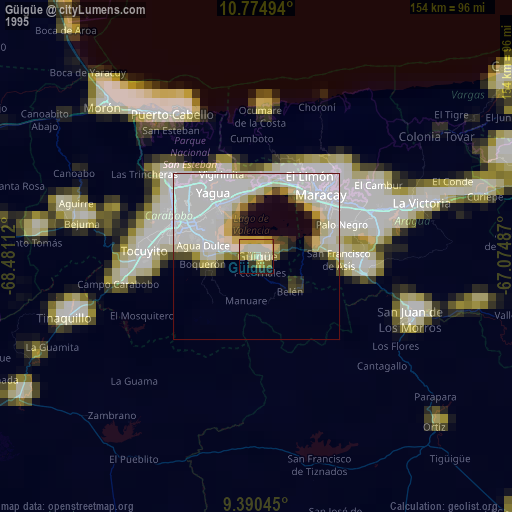
» NASA, Earths city lights 1995
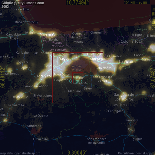
» NASA city lights 2003
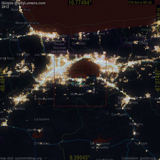
» Earth at Night: Flat Maps 2012, 2016