Guacara night lights from space
Night Light of Guacara (Carabobo) from space (Venezuela) Src. Average luminocity for 10x10km area is 72.7438% and for 50x50km: 27.9427%.
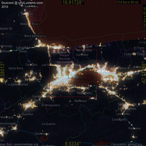
Analysis of Guacara night lights 2016
Square area 10x10 km:
 25%
25%90-99
22.31%80-89
4.55%70-79
4.34%60-69
10.95%50-59
4.55%40-49
7.23%30-39
11.16%20-29
8.26%10-19
1.65%0-9
0%Square area 50x50 km:
6.46%90-99
5.56%80-89
1.32%70-79
4.04%60-69
3.92%50-59
3.21%40-49
3.2%30-39
4.05%20-29
6.63%10-19
14.55%0-9
47.06%Clear (daylight) street map image can be seen on geolist.org.
Map coordinates:
10° 55' 2.2" North, 68° 34' 48.5" West
10° 13' 33.9" North, 67° 52' 37.2" West
9° 32' 0.2" North, 67° 10' 26" West
Some cities around Guacara sort by population:
• Maracay
31.3 km =19.4 mi,  88°
88°
• Valencia
16 km =9.9 mi,  243°
243°
• Puerto Cabello
31.2 km =19.4 mi,  331°
331°
• El Limón
28.2 km =17.5 mi,  71°
71°
• Mariara
19.1 km =11.9 mi, 66°
• Güigüe
19.2 km =11.9 mi,  145°
145°
• San Joaquín
9.9 km =6.2 mi, 67°
• Tacarigua
16.2 km =10.1 mi,  196°
196°
3640465 (p: 151,752)
Sources (retrieved 2019-11-25):
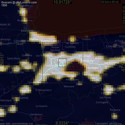
» NASA, Earths city lights 1995
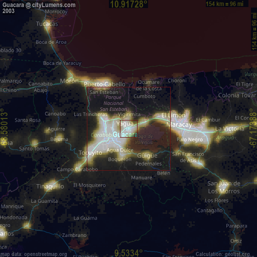
» NASA city lights 2003
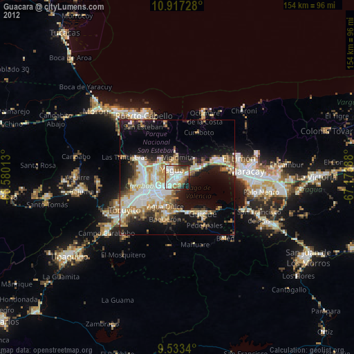
» Earth at Night: Flat Maps 2012, 2016