San Fernando de Apure night lights from space
Night Light of San Fernando de Apure (Apure) from space (Venezuela) Src. Average luminocity for 10x10km area is 44.9318% and for 50x50km: 3.3685%.
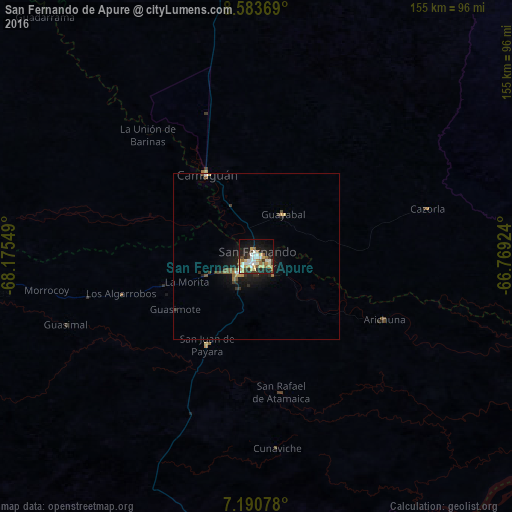
Analysis of San Fernando de Apure night lights 2016
Square area 10x10 km:
 6.4%
6.4%90-99
11.16%80-89
8.68%70-79
6.61%60-69
5.79%50-59
3.31%40-49
3.31%30-39
5.79%20-29
9.3%10-19
25.62%0-9
14.05%Square area 50x50 km:
0.29%90-99
0.53%80-89
0.48%70-79
0.44%60-69
0.4%50-59
0.45%40-49
0.43%30-39
0.61%20-29
0.7%10-19
3.08%0-9
92.59%Clear (daylight) street map image can be seen on geolist.org.
Map coordinates:
8° 35' 1.3" North, 68° 10' 31.8" West
7° 53' 16.2" North, 67° 28' 20.5" West
7° 11' 26.8" North, 66° 46' 9.3" West
Some cities around San Fernando de Apure sort by population:
• Calabozo
115.3 km =71.6 mi,  2°
2°
• Valle de La Pascua
218.5 km =135.8 mi,  47°
47°
• San Juan de los Morros
225.4 km =140.1 mi, 3°
• Tinaquillo
243.6 km =151.4 mi,  337°
337°
• San Carlos
231.9 km =144.1 mi,  328°
328°
• Villa de Cura
239.2 km =148.6 mi,  359°
359°
• Villa Bruzual
242 km =150.4 mi,  311°
311°
• Puerto Carreño, CO
188.9 km =117.4 mi,  180°
180°
3805673 (p: 78,779)
Sources (retrieved 2019-11-25):
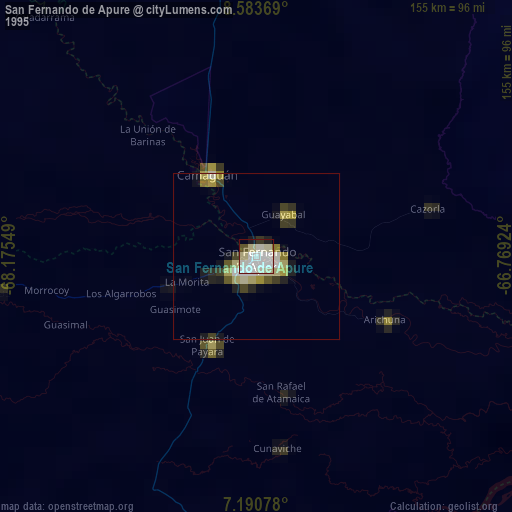
» NASA, Earths city lights 1995
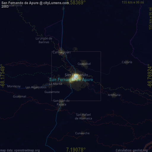
» NASA city lights 2003
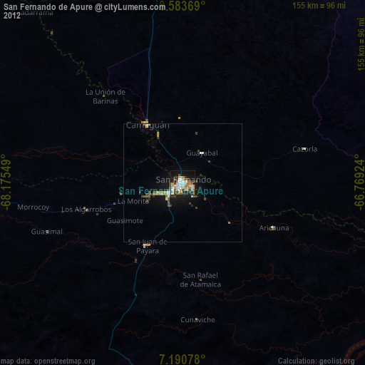
» Earth at Night: Flat Maps 2012, 2016