Calabozo night lights from space
Night Light of Calabozo (Guárico) from space (Venezuela) Src. Average luminocity for 10x10km area is 40.7273% and for 50x50km: 2.394%.
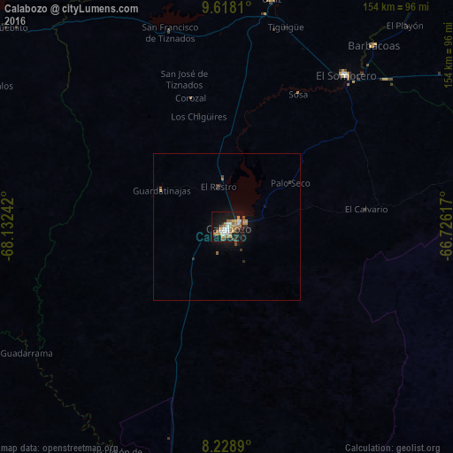
Analysis of Calabozo night lights 2016
Square area 10x10 km:
 6.49%
6.49%90-99
6.93%80-89
1.73%70-79
8.01%60-69
12.34%50-59
4.98%40-49
1.73%30-39
3.46%20-29
7.14%10-19
35.5%0-9
11.69%Square area 50x50 km:
0.25%90-99
0.29%80-89
0.09%70-79
0.48%60-69
0.58%50-59
0.31%40-49
0.1%30-39
0.36%20-29
0.4%10-19
2.37%0-9
94.77%Clear (daylight) street map image can be seen on geolist.org.
Map coordinates:
9° 37' 5.2" North, 68° 7' 56.7" West
8° 55' 27" North, 67° 25' 45.4" West
8° 13' 44" North, 66° 43' 34.2" West
Some cities around Calabozo sort by population:
• Palo Negro
139.5 km =86.7 mi,  354°
354°
• Cagua
140.4 km =87.2 mi,  358°
358°
• San Juan de los Morros
110.1 km =68.4 mi,  4°
4°
• San Fernando de Apure
115.3 km =71.6 mi,  182°
182°
• Villa de Cura
124.1 km =77.1 mi, 356°
• Güigüe
134.5 km =83.6 mi,  343°
343°
• San Mateo
143.3 km =89 mi, 0°
• Tacarigua
140 km =87 mi, 337°
3647444 (p: 117,132)
Sources (retrieved 2019-11-25):
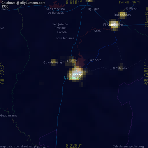
» NASA, Earths city lights 1995
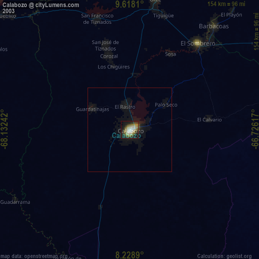
» NASA city lights 2003
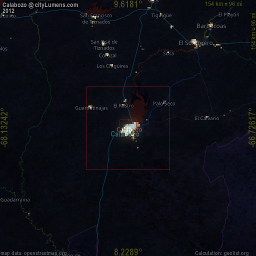
» Earth at Night: Flat Maps 2012, 2016