Lagunillas night lights from space
Night Light of Lagunillas (Zulia) from space (Venezuela) Src. Average luminocity for 10x10km area is 51.6157% and for 50x50km: 16.6548%.
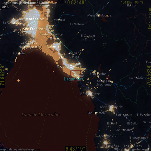
Analysis of Lagunillas night lights 2016
Square area 10x10 km:
 2.69%
2.69%90-99
3.31%80-89
3.51%70-79
7.02%60-69
48.35%50-59
0%40-49
0%30-39
2.27%20-29
9.3%10-19
19.42%0-9
4.13%Square area 50x50 km:
1.59%90-99
1.96%80-89
1.05%70-79
1.71%60-69
10.44%50-59
0.2%40-49
0.9%30-39
1.94%20-29
3.86%10-19
8.11%0-9
68.23%Clear (daylight) street map image can be seen on geolist.org.
Map coordinates:
10° 49' 17.3" North, 71° 57' 45.3" West
10° 7' 48.3" North, 71° 15' 34.1" West
9° 26' 13.9" North, 70° 33' 22.8" West
Some cities around Lagunillas sort by population:
• Maracaibo
71.1 km =44.2 mi,  327°
327°
• Cabimas
36.6 km =22.7 mi,  324°
324°
• Carora
129.1 km =80.2 mi,  87°
87°
• Valera
115.4 km =71.7 mi,  141°
141°
• La Villa del Rosario
117.4 km =72.9 mi,  280°
280°
• Machiques
141.7 km =88 mi,  266°
266°
• Trujillo
123.9 km =77 mi,  133°
133°
• Santa Rita
52.9 km =32.9 mi, 328°
3637623 (p: 44,257)
Sources (retrieved 2019-11-25):
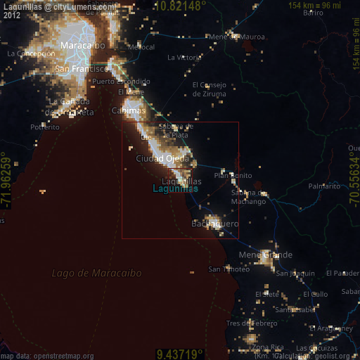
» Earth at Night: Flat Maps 2012, 2016