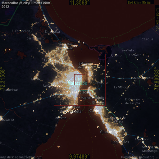
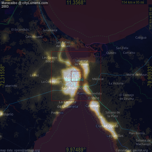
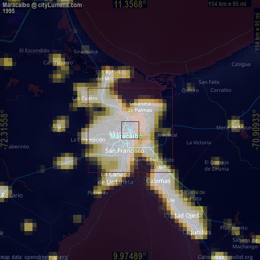
Maracaibo night lights from space
Night Light of Maracaibo (Zulia) from space (Venezuela) Src. Average luminocity for 10x10km area is 91.2004% and for 50x50km: 40.323%.
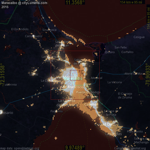
Analysis of Maracaibo night lights 2016
Square area 10x10 km:
 51.86%
90-99
17.56%80-89
6.4%70-79
18.6%60-69
3.1%50-59
0%40-49
2.48%30-39
0%20-29
0%10-19
0%0-9
0%Square area 50x50 km:
8.76%90-99
5.43%80-89
3.18%70-79
7.35%60-69
13.86%50-59
1.61%40-49
3.2%30-39
6.14%20-29
8.6%10-19
13.45%0-9
28.42%Clear (daylight) street map image can be seen on geolist.org.
Map coordinates:
11° 21' 24.5" North, 72° 18' 56.1" West
10° 39' 59.9" North, 71° 36' 44.8" West
9° 58' 29.6" North, 70° 54' 33.6" West
Some cities around Maracaibo sort by population:
• Cabimas
34.5 km =21.4 mi,  149°
149°
• Maicao, CO
104.6 km =65 mi,  319°
319°
• La Villa del Rosario
85.5 km =53.1 mi,  243°
243°
• Machiques
122.9 km =76.4 mi, 236°
• Lagunillas
71.1 km =44.2 mi, 147°
• Santa Rita
18.2 km =11.3 mi,  142°
142°
• Barrancas, CO
133.1 km =82.7 mi,  284°
284°
• Albania, CO
120.3 km =74.8 mi,  297°
297°
3633009 (p: 2,225,000)
Sources (retrieved 2019-11-25):
» NASA, Earths city lights 1995
» NASA city lights 2003
» Earth at Night: Flat Maps 2012, 2016