La Villa del Rosario night lights from space
Night Light of La Villa del Rosario (Zulia) from space (Venezuela) Src. Average luminocity for 10x10km area is 34.157% and for 50x50km: 1.9355%.
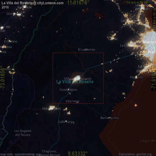
Analysis of La Villa del Rosario night lights 2016
Square area 10x10 km:
 7.85%
7.85%90-99
9.71%80-89
6.4%70-79
1.45%60-69
1.03%50-59
0.41%40-49
1.24%30-39
3.72%20-29
3.72%10-19
38.64%0-9
25.83%Square area 50x50 km:
0.32%90-99
0.4%80-89
0.29%70-79
0.07%60-69
0.2%50-59
0.05%40-49
0.12%30-39
0.35%20-29
0.23%10-19
2.05%0-9
95.92%Clear (daylight) street map image can be seen on geolist.org.
Map coordinates:
11° 1' 0.3" North, 73° 0' 59.6" West
10° 19' 32.9" North, 72° 18' 48.3" West
9° 37' 60" North, 71° 36' 37.1" West
Some cities around La Villa del Rosario sort by population:
• Maracaibo
85.5 km =53.1 mi,  63°
63°
• Machiques
39.4 km =24.5 mi,  221°
221°
• Fonseca, CO
85.5 km =53.1 mi,  316°
316°
• Villanueva, CO
79.2 km =49.2 mi,  293°
293°
• Barrancas, CO
87.7 km =54.5 mi, 323°
• Urumita, CO
80.7 km =50.1 mi, 288°
• Manaure Balcón del Cesar, CO
79 km =49.1 mi,  275°
275°
• El Molino, CO
76.1 km =47.3 mi,  298°
298°
3628966 (p: 65,011)
Sources (retrieved 2019-11-25):
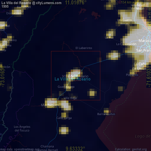
» NASA, Earths city lights 1995
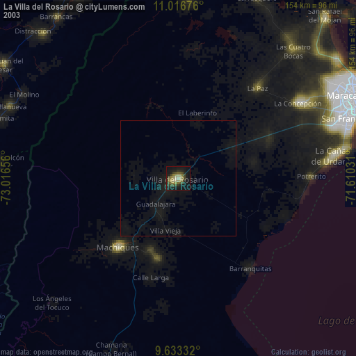
» NASA city lights 2003
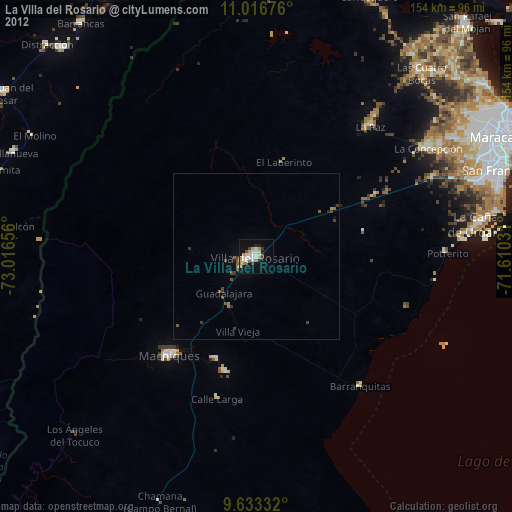
» Earth at Night: Flat Maps 2012, 2016