Cabimas night lights from space
Night Light of Cabimas (Zulia) from space (Venezuela) Src. Average luminocity for 10x10km area is 74.9525% and for 50x50km: 32.7439%.
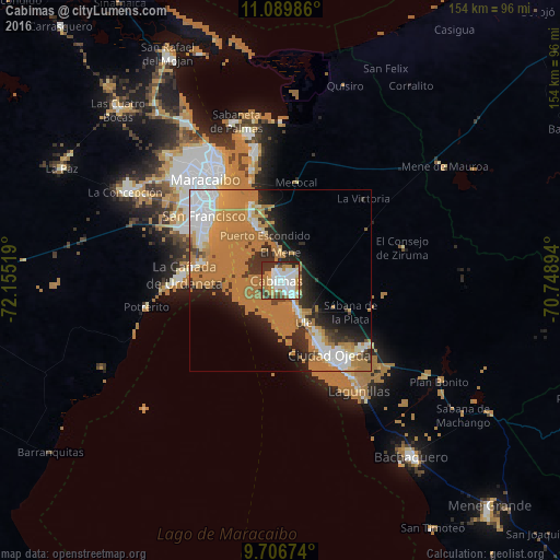
Analysis of Cabimas night lights 2016
Square area 10x10 km:
 23.97%
90-99
20.66%80-89
5.79%70-79
12.19%60-69
11.78%50-59
2.48%40-49
5.99%30-39
9.09%20-29
8.06%10-19
0%0-9
0%Square area 50x50 km:
5.12%90-99
4.11%80-89
1.93%70-79
5.09%60-69
20.19%50-59
0.43%40-49
1.22%30-39
3.34%20-29
6.57%10-19
7.77%0-9
44.23%Clear (daylight) street map image can be seen on geolist.org.
Map coordinates:
11° 5' 23.5" North, 72° 9' 18.7" West
10° 23' 56.7" North, 71° 27' 7.4" West
9° 42' 24.3" North, 70° 44' 56.2" West
Some cities around Cabimas sort by population:
• Maracaibo
34.5 km =21.4 mi,  329°
329°
• Maicao, CO
138.7 km =86.2 mi,  321°
321°
• Valera
152 km =94.4 mi,  142°
142°
• La Villa del Rosario
94.6 km =58.8 mi,  265°
265°
• Machiques
126.1 km =78.4 mi,  252°
252°
• Lagunillas
36.6 km =22.7 mi, 144°
• Santa Rita
16.6 km =10.3 mi,  337°
337°
• Albania, CO
150.6 km =93.6 mi,  304°
304°
3647651 (p: 200,818)
Sources (retrieved 2019-11-25):
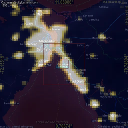
» NASA, Earths city lights 1995
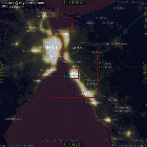
» NASA city lights 2003
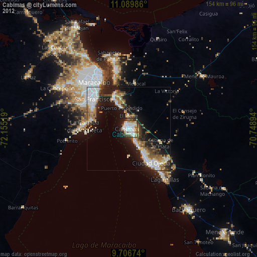
» Earth at Night: Flat Maps 2012, 2016