Chichiriviche night lights from space
Night Light of Chichiriviche (Falcón) from space (Venezuela) Src. Average luminocity for 10x10km area is 9.0541% and for 50x50km: 2.5726%.
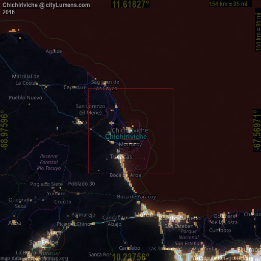
Analysis of Chichiriviche night lights 2016
Square area 10x10 km:
 0.43%
0.43%90-99
0.43%80-89
0%70-79
3.68%60-69
2.81%50-59
1.08%40-49
0.65%30-39
2.16%20-29
0.87%10-19
0%0-9
87.88%Square area 50x50 km:
0.12%90-99
0.12%80-89
0.03%70-79
0.99%60-69
0.57%50-59
0.34%40-49
0.42%30-39
0.2%20-29
0.26%10-19
1.9%0-9
95.06%Clear (daylight) street map image can be seen on geolist.org.
Map coordinates:
11° 37' 5.8" North, 68° 58' 33.5" West
10° 55' 43.4" North, 68° 16' 22.2" West
10° 14' 15.2" North, 67° 34' 11" West
Some cities around Chichiriviche sort by population:
• Valencia
90 km =55.9 mi,  161°
161°
• Puerto Cabello
58.1 km =36.1 mi,  150°
150°
• Guacara
89.3 km =55.5 mi, 151°
• San Felipe
83.2 km =51.7 mi,  218°
218°
• Morón
49.7 km =30.9 mi,  170°
170°
• San Joaquín
90.9 km =56.5 mi,  144°
144°
• Nirgua
92.2 km =57.3 mi,  200°
200°
• Tucacas
16.5 km =10.3 mi, 200°
3645806 (p: 12,500)
Sources (retrieved 2019-11-25):
» Earth at Night: Flat Maps 2012, 2016