Yorba Linda night lights from space
Night Light of Yorba Linda (California) from space (United States) Src. Average luminocity for 10x10km area is 78.0752% and for 50x50km: 77.0546%.
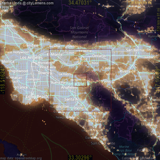
Analysis of Yorba Linda night lights 2016
Square area 10x10 km:
 16.26%
90-99
17.13%80-89
10.84%70-79
20.63%60-69
20.28%50-59
8.74%40-49
5.59%30-39
0.52%20-29
0%10-19
0%0-9
0%Square area 50x50 km:
29.07%90-99
22.86%80-89
7.51%70-79
9.52%60-69
9.14%50-59
4.54%40-49
4.21%30-39
2.59%20-29
2.22%10-19
3.18%0-9
5.15%Clear (daylight) street map image can be seen on geolist.org.
Map coordinates:
34° 28' 13.1" North, 118° 30' 58.5" West
33° 53' 19.1" North, 117° 48' 47.2" West
33° 18' 10.7" North, 117° 6' 36" West
Some cities around Yorba Linda sort by population:
• Anaheim
11.1 km =6.9 mi,  237°
237°
• Orange
11.8 km =7.3 mi,  198°
198°
• Fullerton
10.6 km =6.6 mi,  258°
258°
• Chino Hills
12.7 km =7.9 mi,  23°
23°
• Placentia
5.6 km =3.5 mi,  250°
250°
• Rowland Heights
12.9 km =8 mi,  318°
318°
• Brea
8.6 km =5.3 mi,  291°
291°
• Villa Park
8.2 km =5.1 mi,  180°
180°
5410902 (p: 67,973)
Sources (retrieved 2019-11-25):
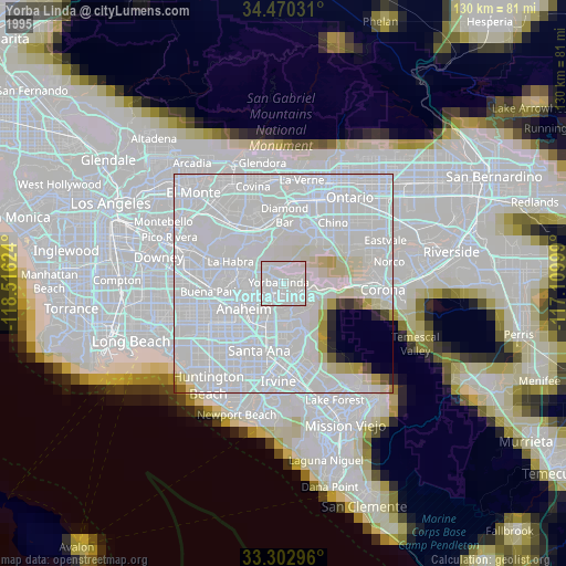
» NASA, Earths city lights 1995
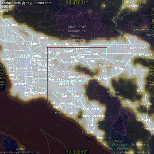
» NASA city lights 2003
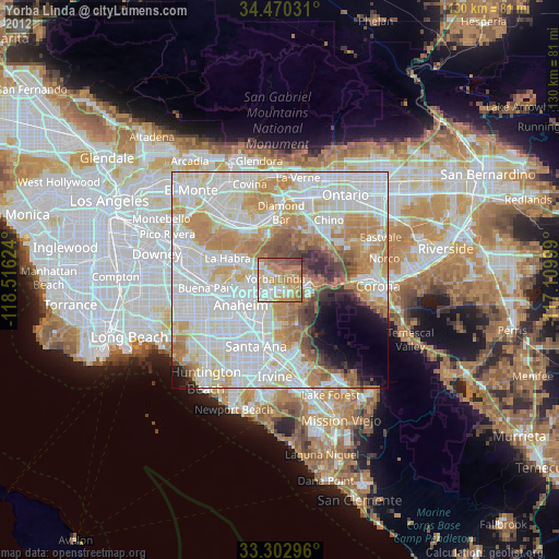
» Earth at Night: Flat Maps 2012, 2016