Brea night lights from space
Night Light of Brea (California) from space (United States) Src. Average luminocity for 10x10km area is 84.8129% and for 50x50km: 82.0908%.
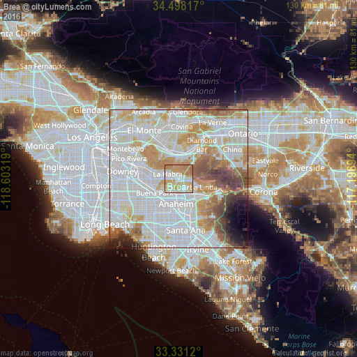
Analysis of Brea night lights 2016
Square area 10x10 km:
 21.5%
21.5%90-99
22.38%80-89
16.43%70-79
22.03%60-69
17.48%50-59
0.17%40-49
0%30-39
0%20-29
0%10-19
0%0-9
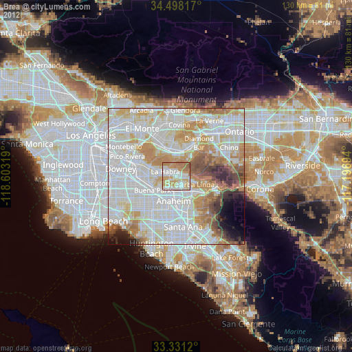
0%Square area 50x50 km:
32.46%90-99
25.32%80-89
8%70-79
9.62%60-69
8%50-59
4.34%40-49
4.14%30-39
2.52%20-29
1.85%10-19
2.01%0-9
1.75%Clear (daylight) street map image can be seen on geolist.org.
Map coordinates:
34° 29' 53.4" North, 118° 36' 11.5" West
33° 55' 0" North, 117° 54' 0.2" West
33° 19' 52.3" North, 117° 11' 49" West
Some cities around Brea sort by population:
• Anaheim
9.1 km =5.7 mi,  188°
188°
• Fullerton
5.7 km =3.5 mi,  204°
204°
• Yorba Linda
8.6 km =5.3 mi,  111°
111°
• La Habra
4.6 km =2.9 mi,  291°
291°
• Placentia
5.7 km =3.5 mi,  150°
150°
• Rowland Heights
6.6 km =4.1 mi,  355°
355°
• East La Mirada
8.2 km =5.1 mi,  276°
276°
• La Habra Heights
6.8 km =4.2 mi,  316°
316°
5330582 (p: 41,944)
Sources (retrieved 2019-11-25):
» Earth at Night: Flat Maps 2012, 2016