Orange night lights from space
Night Light of Orange (California) from space (United States) Src. Average luminocity for 10x10km area is 93.208% and for 50x50km: 69.1973%.
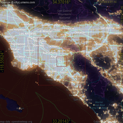
Analysis of Orange night lights 2016
Square area 10x10 km:
 43.88%
90-99
31.47%80-89
8.22%70-79
12.06%60-69
4.37%50-59
0%40-49
0%30-39
0%20-29
0%10-19
0%0-9
0%Square area 50x50 km:
23.91%90-99
18.25%80-89
6.23%70-79
9.17%60-69
10.53%50-59
6%40-49
5.53%30-39
3.3%20-29
3.75%10-19
4.39%0-9
8.94%Clear (daylight) street map image can be seen on geolist.org.
Map coordinates:
34° 22' 12.6" North, 118° 33' 22.5" West
33° 47' 16" North, 117° 51' 11.2" West
33° 12' 5.1" North, 117° 8' 60" West
Some cities around Orange sort by population:
• Anaheim
7.7 km =4.8 mi,  312°
312°
• Santa Ana
4.9 km =3 mi,  196°
196°
• Garden Grove
8.3 km =5.2 mi,  259°
259°
• Fullerton
11.3 km =7 mi,  323°
323°
• Tustin
5.3 km =3.3 mi,  151°
151°
• Placentia
9.5 km =5.9 mi,  350°
350°
• North Tustin
6.1 km =3.8 mi,  115°
115°
• Villa Park
4.7 km =2.9 mi,  51°
51°
5379513 (p: 140,992)
Sources (retrieved 2019-11-25):
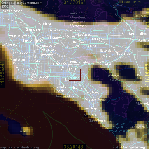
» NASA, Earths city lights 1995
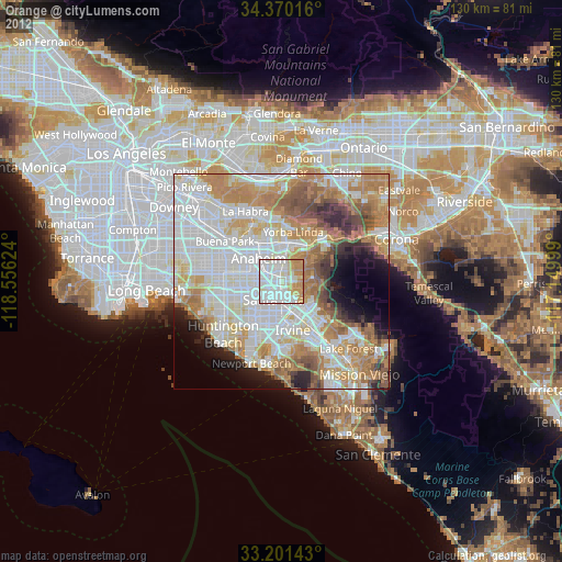
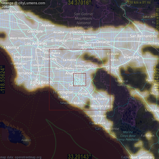
» NASA city lights 2003
» Earth at Night: Flat Maps 2012, 2016