Wyoming night lights from space
Night Light of Wyoming (Minnesota) from space (United States) Src. Average luminocity for 10x10km area is 8.5952% and for 50x50km: 9.444%.
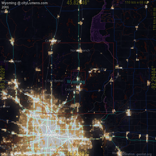
Analysis of Wyoming night lights 2016
Square area 10x10 km:
 0.79%
0.79%90-99
1.11%80-89
0%70-79
0.63%60-69
0.63%50-59
1.43%40-49
1.27%30-39
1.43%20-29
2.7%10-19
9.52%0-9
80.48%Square area 50x50 km:
0.97%90-99
1.1%80-89
0.87%70-79
1.01%60-69
2%50-59
1.94%40-49
2.41%30-39
1.4%20-29
1.96%10-19
5.05%0-9
81.3%Clear (daylight) street map image can be seen on geolist.org.
Map coordinates:
45° 49' 42.5" North, 93° 42' 1" West
45° 20' 10.9" North, 92° 59' 49.8" West
44° 50' 23.8" North, 92° 17' 38.5" West
Some cities around Wyoming sort by population:
• Andover
25.7 km =16 mi,  243°
243°
• Lino Lakes
20.9 km =13 mi,  200°
200°
• Forest Lake
6.5 km =4 mi,  171°
171°
• Ham Lake
22 km =13.7 mi, 244°
• Hugo
19.6 km =12.2 mi,  179°
179°
• East Bethel
16.2 km =10.1 mi,  263°
263°
• North Branch
19.5 km =12.1 mi,  3°
3°
• Oak Grove
25.8 km =16 mi,  271°
271°
5053526 (p: 7,813)
Sources (retrieved 2019-11-25):
» Earth at Night: Flat Maps 2012, 2016