Hugo night lights from space
Night Light of Hugo (Minnesota) from space (United States) Src. Average luminocity for 10x10km area is 18.7667% and for 50x50km: 30.6214%.
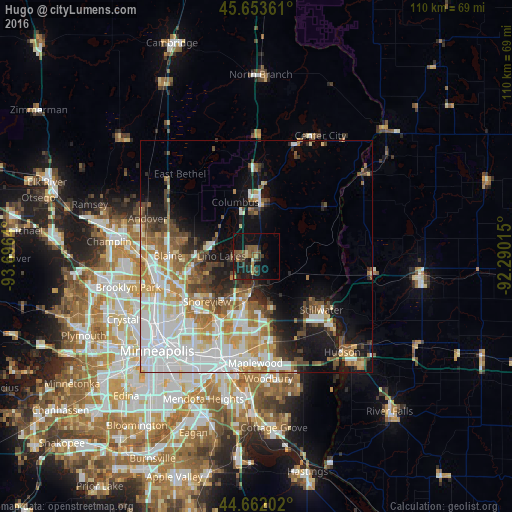
Analysis of Hugo night lights 2016
Square area 10x10 km:
 0%
0%90-99
0.61%80-89
1.82%70-79
1.82%60-69
2.12%50-59
5.45%40-49
7.12%30-39
2.88%20-29
7.42%10-19
21.06%0-9
49.7%Square area 50x50 km:
9.37%90-99
6.14%80-89
3.03%70-79
3.69%60-69
4.02%50-59
3.24%40-49
3.85%30-39
2.31%20-29
3.94%10-19
9.57%0-9
50.84%Clear (daylight) street map image can be seen on geolist.org.
Map coordinates:
45° 39' 13" North, 93° 41' 47" West
45° 9' 35.9" North, 92° 59' 35.8" West
44° 39' 43.3" North, 92° 17' 24.5" West
Some cities around Hugo sort by population:
• Shoreview
15.1 km =9.4 mi,  233°
233°
• White Bear Lake
8.5 km =5.3 mi,  188°
188°
• Lino Lakes
7.5 km =4.7 mi,  270°
270°
• Forest Lake
13.2 km =8.2 mi,  2°
2°
• Vadnais Heights
13 km =8.1 mi,  209°
209°
• North Saint Paul
16.4 km =10.2 mi,  179°
179°
• Little Canada
16.5 km =10.3 mi, 206°
• Mahtomedi
10.6 km =6.6 mi,  161°
161°
5030884 (p: 14,388)
Sources (retrieved 2019-11-25):
» Earth at Night: Flat Maps 2012, 2016