North Branch night lights from space
Night Light of North Branch (Minnesota) from space (United States) Src. Average luminocity for 10x10km area is 7.7254% and for 50x50km: 3.0599%.
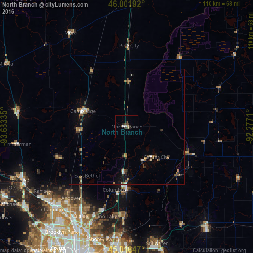
Analysis of North Branch night lights 2016
Square area 10x10 km:
 0.48%
0.48%90-99
1.43%80-89
0%70-79
0.63%60-69
1.27%50-59
1.27%40-49
2.54%30-39
1.27%20-29
3.17%10-19
0.63%0-9
87.3%Square area 50x50 km:
0.2%90-99
0.35%80-89
0.25%70-79
0.28%60-69
0.61%50-59
0.54%40-49
0.64%30-39
0.49%20-29
0.61%10-19
1.5%0-9
94.54%Clear (daylight) street map image can be seen on geolist.org.
Map coordinates:
46° 0' 6.9" North, 93° 41' 0.1" West
45° 30' 40.9" North, 92° 58' 48.8" West
45° 0' 59.3" North, 92° 16' 37.6" West
Some cities around North Branch sort by population:
• Forest Lake
25.9 km =16.1 mi,  180°
180°
• Ham Lake
35.9 km =22.3 mi,  215°
215°
• East Bethel
27.5 km =17.1 mi, 219°
• Cambridge
20.2 km =12.6 mi,  289°
289°
• Oak Grove
33 km =20.5 mi,  234°
234°
• Wyoming
19.5 km =12.1 mi, 183°
• Saint Francis
32.7 km =20.3 mi,  244°
244°
• Isanti
21 km =13 mi,  263°
263°
5039421 (p: 10,215)
Sources (retrieved 2019-11-25):
» Earth at Night: Flat Maps 2012, 2016