Winnetka night lights from space
Night Light of Winnetka (Illinois) from space (United States) Src. Average luminocity for 10x10km area is 54.6742% and for 50x50km: 47.8595%.
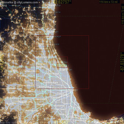
Analysis of Winnetka night lights 2016
Square area 10x10 km:
 5.45%
5.45%90-99
8.64%80-89
11.52%70-79
19.24%60-69
8.03%50-59
8.03%40-49
2.73%30-39
3.03%20-29
12.12%10-19
11.97%0-9
9.24%Square area 50x50 km:
21.47%90-99
11.92%80-89
5.22%70-79
3.81%60-69
5%50-59
3.82%40-49
1.65%30-39
0.95%20-29
2.18%10-19
3.15%0-9
40.83%Clear (daylight) street map image can be seen on geolist.org.
Map coordinates:
42° 37' 39.3" North, 88° 26' 20.5" West
42° 6' 29.1" North, 87° 44' 9.2" West
41° 35' 3.5" North, 87° 1' 58" West
Some cities around Winnetka sort by population:
• Evanston
8.3 km =5.2 mi,  153°
153°
• Skokie
8.3 km =5.2 mi,  178°
178°
• Glenview
6 km =3.7 mi,  225°
225°
• Northbrook
8 km =5 mi,  285°
285°
• Wilmette
4.1 km =2.5 mi,  164°
164°
• Morton Grove
8.4 km =5.2 mi,  207°
207°
• Glencoe
3.5 km =2.2 mi,  328°
328°
• Northfield
3.8 km =2.4 mi,  255°
255°
4916891 (p: 12,472)
Sources (retrieved 2019-11-25):
» Earth at Night: Flat Maps 2012, 2016