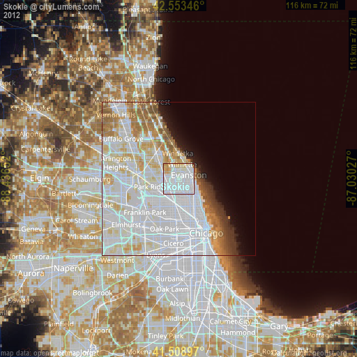
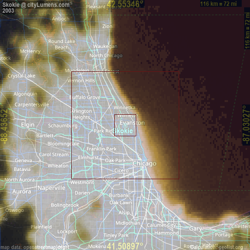
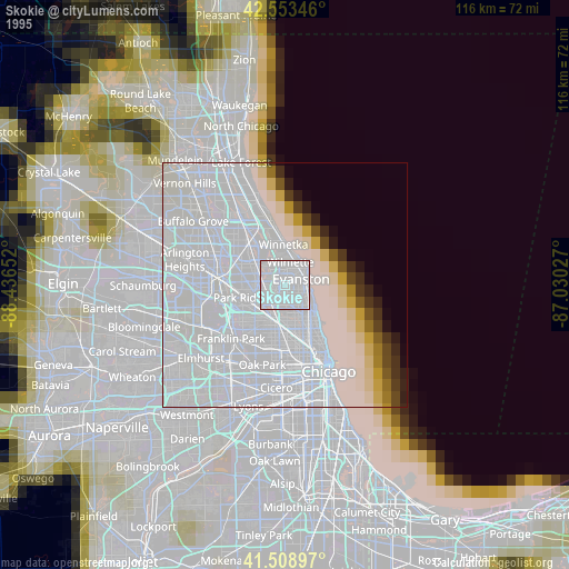
Skokie night lights from space
Night Light of Skokie (Illinois) from space (United States) Src. Average luminocity for 10x10km area is 96.4127% and for 50x50km: 56.0727%.
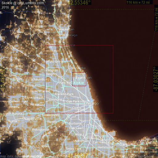
Analysis of Skokie night lights 2016
Square area 10x10 km:
 62.22%
90-99
24.13%80-89
7.14%70-79
6.19%60-69
0%50-59
0%40-49
0%30-39
0.16%20-29
0.16%10-19
0%0-9
0%Square area 50x50 km:
28.55%90-99
14.46%80-89
5.58%70-79
3.45%60-69
3.64%50-59
2.99%40-49
1.5%30-39
1.21%20-29
1.99%10-19
3.08%0-9
33.56%Clear (daylight) street map image can be seen on geolist.org.
Map coordinates:
42° 33' 12.5" North, 88° 26' 11.5" West
42° 2' 0.1" North, 87° 44' 0.2" West
41° 30' 32.3" North, 87° 1' 49" West
Some cities around Skokie sort by population:
• Evanston
3.7 km =2.3 mi,  76°
76°
• West Ridge
5 km =3.1 mi,  138°
138°
• Rogers Park
6.2 km =3.9 mi,  116°
116°
• Glenview
6 km =3.7 mi,  311°
311°
• Niles
6 km =3.7 mi,  254°
254°
• Wilmette
4.4 km =2.7 mi,  11°
11°
• Morton Grove
4.1 km =2.5 mi,  281°
281°
• Lincolnwood
3.2 km =2 mi,  175°
175°
4911600 (p: 64,821)
Sources (retrieved 2019-11-25):
» NASA, Earths city lights 1995
» NASA city lights 2003
» Earth at Night: Flat Maps 2012, 2016