Northbrook night lights from space
Night Light of Northbrook (Illinois) from space (United States) Src. Average luminocity for 10x10km area is 83.9652% and for 50x50km: 57.7942%.
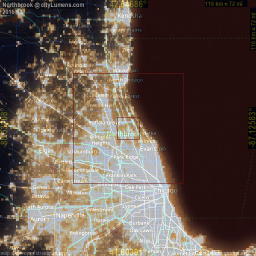
Analysis of Northbrook night lights 2016
Square area 10x10 km:
 21.82%
90-99
22.42%80-89
17.42%70-79
18.94%60-69
12.27%50-59
5.45%40-49
1.36%30-39
0%20-29
0.3%10-19
0%0-9
0%Square area 50x50 km:
22.35%90-99
14.34%80-89
7.29%70-79
5.46%60-69
7.06%50-59
6.17%40-49
3.16%30-39
1.91%20-29
2.54%10-19
3.19%0-9
26.53%Clear (daylight) street map image can be seen on geolist.org.
Map coordinates:
42° 38' 48.7" North, 88° 31' 55.5" West
42° 7' 39.1" North, 87° 49' 44.2" West
41° 36' 14.1" North, 87° 7' 33" West
Some cities around Northbrook sort by population:
• Glenview
7.3 km =4.5 mi,  152°
152°
• Wheeling
8.3 km =5.2 mi,  278°
278°
• Highland Park
6.5 km =4 mi,  21°
21°
• Deerfield
5 km =3.1 mi,  345°
345°
• Winnetka
8 km =5 mi,  105°
105°
• Glencoe
5.9 km =3.7 mi,  81°
81°
• Lincolnshire
9.5 km =5.9 mi,  316°
316°
• Highwood
8.2 km =5.1 mi,  11°
11°
4904056 (p: 33,663)
Sources (retrieved 2019-11-25):
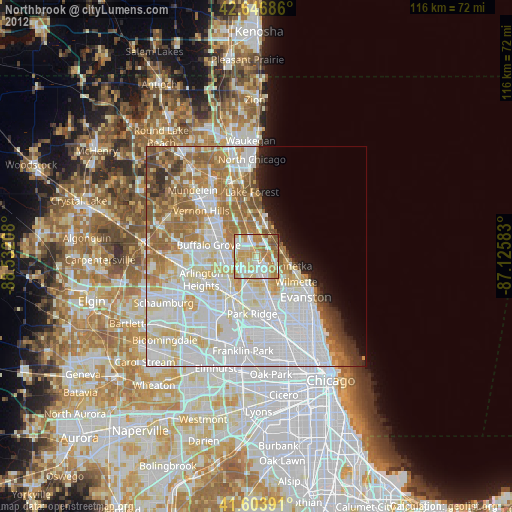
» Earth at Night: Flat Maps 2012, 2016