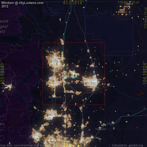
Windsor night lights from space
Night Light of Windsor (Colorado) from space (United States) Src. Average luminocity for 10x10km area is 38.1497% and for 50x50km: 20.8343%.

Analysis of Windsor night lights 2016
Square area 10x10 km:
 1.87%
1.87%90-99
3.74%80-89
7.48%70-79
5.27%60-69
5.1%50-59
6.12%40-49
6.63%30-39
11.56%20-29
16.5%10-19
33.33%0-9
2.38%Square area 50x50 km:
2.24%90-99
2.79%80-89
2.63%70-79
2.76%60-69
3.52%50-59
3.46%40-49
3.12%30-39
4.33%20-29
6.09%10-19
13.29%0-9
55.77%Clear (daylight) street map image can be seen on geolist.org.
Map coordinates:
41° 0' 36.7" North, 105° 36' 16.2" West
40° 28' 38.9" North, 104° 54' 4.9" West
39° 56' 25.8" North, 104° 11' 53.7" West
Some cities around Windsor sort by population:
• Fort Collins
19.6 km =12.2 mi,  307°
307°
• Greeley
17.3 km =10.7 mi,  110°
110°
• Loveland
17.2 km =10.7 mi,  238°
238°
• Evans
21 km =13 mi,  122°
122°
• Johnstown
15.7 km =9.8 mi,  183°
183°
• Wellington
26.8 km =16.7 mi,  340°
340°
• Milliken
16.9 km =10.5 mi,  166°
166°
• Berthoud
24.2 km =15 mi,  218°
218°
5583509 (p: 21,751)
Sources (retrieved 2019-11-25):
» Earth at Night: Flat Maps 2012, 2016