Greeley night lights from space
Night Light of Greeley (Colorado) from space (United States) Src. Average luminocity for 10x10km area is 67.5884% and for 50x50km: 12.4101%.
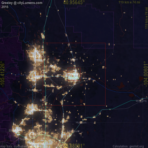
Analysis of Greeley night lights 2016
Square area 10x10 km:
 18.37%
90-99
21.43%80-89
6.63%70-79
7.14%60-69
7.99%50-59
6.12%40-49
4.59%30-39
6.63%20-29
16.5%10-19
4.59%0-9
0%Square area 50x50 km:
1.04%90-99
1.32%80-89
1.55%70-79
1.59%60-69
1.97%50-59
2.11%40-49
1.74%30-39
2.99%20-29
4.03%10-19
9.79%0-9
71.88%Clear (daylight) street map image can be seen on geolist.org.
Map coordinates:
40° 57' 23.2" North, 105° 24' 44.1" West
40° 25' 23.9" North, 104° 42' 32.9" West
39° 53' 9.3" North, 104° 0' 21.6" West
Some cities around Greeley sort by population:
• Fort Collins
36.5 km =22.7 mi,  299°
299°
• Loveland
31.1 km =19.3 mi,  264°
264°
• Windsor
17.3 km =10.7 mi,  290°
290°
• Evans
5.4 km =3.4 mi,  164°
164°
• Johnstown
19.7 km =12.2 mi,  240°
240°
• Fort Lupton
38.7 km =24 mi,  193°
193°
• Milliken
16.2 km =10.1 mi,  229°
229°
• Berthoud
34 km =21.1 mi,  247°
247°
5577592 (p: 100,883)
Sources (retrieved 2019-11-25):
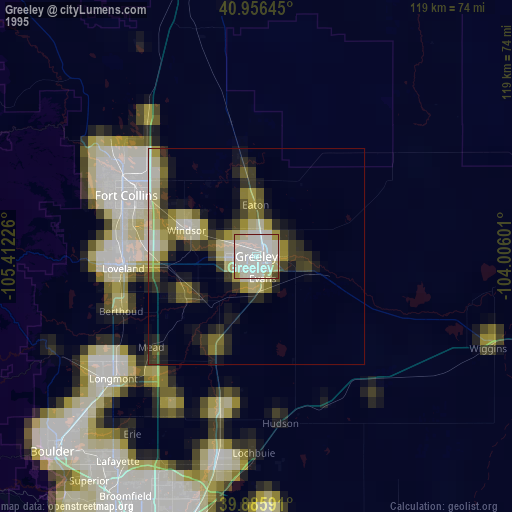
» NASA, Earths city lights 1995
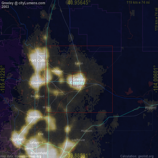
» NASA city lights 2003
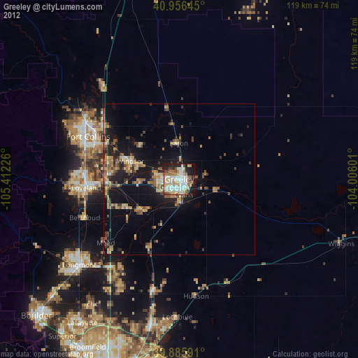
» Earth at Night: Flat Maps 2012, 2016