Wellington night lights from space
Night Light of Wellington (Colorado) from space (United States) Src. Average luminocity for 10x10km area is 9.6429% and for 50x50km: 7.7383%.
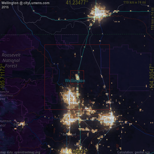
Analysis of Wellington night lights 2016
Square area 10x10 km:
 0.16%
0.16%90-99
0.49%80-89
1.46%70-79
1.79%60-69
2.76%50-59
1.46%40-49
0.49%30-39
2.44%20-29
0.49%10-19
0.16%0-9
88.31%Square area 50x50 km:
0.91%90-99
0.97%80-89
0.76%70-79
0.98%60-69
1.51%50-59
1.53%40-49
1.2%30-39
1.77%20-29
1.98%10-19
4.39%0-9
84%Clear (daylight) street map image can be seen on geolist.org.
Map coordinates:
41° 14' 5.2" North, 105° 42' 42.2" West
40° 42' 13.9" North, 105° 0' 30.9" West
40° 10' 7.4" North, 104° 18' 19.7" West
Some cities around Wellington sort by population:
• Fort Collins
14.7 km =9.1 mi,  205°
205°
• Greeley
40.2 km =25 mi,  140°
140°
• Loveland
34.5 km =21.4 mi,  189°
189°
• Windsor
26.8 km =16.7 mi,  160°
160°
• Evans
45.2 km =28.1 mi, 143°
• Johnstown
41.6 km =25.8 mi,  168°
168°
• Milliken
43.6 km =27.1 mi, 162°
• Berthoud
44.4 km =27.6 mi, 187°
5583250 (p: 7,807)
Sources (retrieved 2019-11-25):
» Earth at Night: Flat Maps 2012, 2016