Clayton night lights from space
Night Light of Clayton (North Carolina) from space (United States) Src. Average luminocity for 10x10km area is 64.2343% and for 50x50km: 42.6137%.
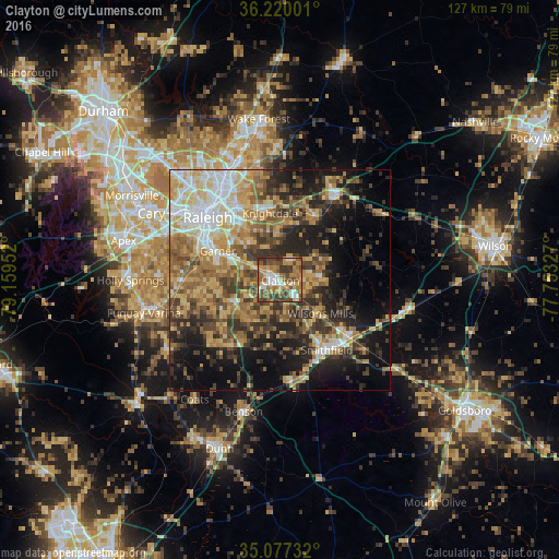
Analysis of Clayton night lights 2016
Square area 10x10 km:
 7.69%
7.69%90-99
10.49%80-89
7.87%70-79
14.34%60-69
13.46%50-59
15.03%40-49
16.61%30-39
13.81%20-29
0.7%10-19
0%0-9
0%Square area 50x50 km:
5.36%90-99
5.29%80-89
8.13%70-79
6.94%60-69
8.11%50-59
6.71%40-49
7.14%30-39
8.69%20-29
9.34%10-19
14.19%0-9
20.11%Clear (daylight) street map image can be seen on geolist.org.
Map coordinates:
36° 13' 12" North, 79° 9' 34.3" West
35° 39' 2.6" North, 78° 27' 23" West
35° 4' 38.4" North, 77° 45' 11.8" West
Some cities around Clayton sort by population:
• Raleigh
21.3 km =13.2 mi,  309°
309°
• West Raleigh
24.1 km =15 mi, 308°
• Garner
15.8 km =9.8 mi,  295°
295°
• Knightdale
15.4 km =9.6 mi,  351°
351°
• Smithfield
19 km =11.8 mi,  146°
146°
• Selma
20.1 km =12.5 mi,  129°
129°
• Rolesville
30.3 km =18.8 mi,  359°
359°
• Wendell
16.5 km =10.3 mi,  28°
28°
4460943 (p: 19,304)
Sources (retrieved 2019-11-25):
» Earth at Night: Flat Maps 2012, 2016