Goldsboro night lights from space
Night Light of Goldsboro (North Carolina) from space (United States) Src. Average luminocity for 10x10km area is 76.3407% and for 50x50km: 16.7655%.

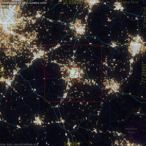
Analysis of Goldsboro night lights 2016
Square area 10x10 km:
 18.68%
90-99
19.96%80-89
16.67%70-79
8.97%60-69
10.99%50-59
7.88%40-49
5.68%30-39
9.71%20-29
1.47%10-19
0%0-9
0%Square area 50x50 km:
1.03%90-99
1.2%80-89
2.34%70-79
2.61%60-69
2.62%50-59
2.48%40-49
3.14%30-39
5.27%20-29
5.42%10-19
12.22%0-9
61.66%Clear (daylight) street map image can be seen on geolist.org.
Map coordinates:
35° 57' 21.9" North, 78° 41' 45.2" West
35° 23' 5.6" North, 77° 59' 34" West
34° 48' 34.6" North, 77° 17' 22.7" West
Some cities around Goldsboro sort by population:
• Wilson
38 km =23.6 mi,  10°
10°
• Kinston
39.7 km =24.7 mi,  110°
110°
• Clayton
51.3 km =31.9 mi,  305°
305°
• Smithfield
34.3 km =21.3 mi,  293°
293°
• Clinton
52.5 km =32.6 mi,  214°
214°
• Selma
31.3 km =19.4 mi,  302°
302°
• Wendell
55.7 km =34.6 mi,  322°
322°
• Ayden
53.2 km =33.1 mi,  79°
79°
4468261 (p: 35,826)
Sources (retrieved 2019-11-25):
» Earth at Night: Flat Maps 2012, 2016