Wickliffe night lights from space
Night Light of Wickliffe (Ohio) from space (United States) Src. Average luminocity for 10x10km area is 78.7614% and for 50x50km: 36.1361%.
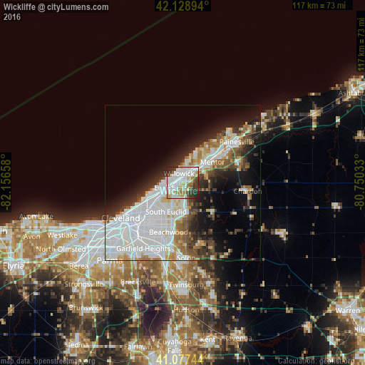
Analysis of Wickliffe night lights 2016
Square area 10x10 km:
 27.27%
90-99
28.25%80-89
7.14%70-79
5.52%60-69
7.63%50-59
2.6%40-49
4.87%30-39
11.2%20-29
5.52%10-19
0%0-9
0%Square area 50x50 km:
13.42%90-99
8.68%80-89
2.56%70-79
2.55%60-69
3.17%50-59
2.96%40-49
3.67%30-39
3.83%20-29
6.3%10-19
9.6%0-9
43.25%Clear (daylight) street map image can be seen on geolist.org.
Map coordinates:
42° 7' 44.2" North, 82° 9' 23.7" West
41° 36' 19.2" North, 81° 27' 12.4" West
41° 4' 38.8" North, 80° 45' 1.2" West
Some cities around Wickliffe sort by population:
• Euclid
6.2 km =3.9 mi,  257°
257°
• Willoughby
5.5 km =3.4 mi,  45°
45°
• Eastlake
5.4 km =3.4 mi,  2°
2°
• Willowick
3.3 km =2.1 mi,  337°
337°
• Richmond Heights
7.5 km =4.7 mi,  218°
218°
• Willoughby Hills
3 km =1.9 mi,  104°
104°
• Highland Heights
6.3 km =3.9 mi,  199°
199°
• Kirtland
8.1 km =5 mi,  71°
71°
5176759 (p: 12,545)
Sources (retrieved 2019-11-25):
» Earth at Night: Flat Maps 2012, 2016