Eastlake night lights from space
Night Light of Eastlake (Ohio) from space (United States) Src. Average luminocity for 10x10km area is 63.0682% and for 50x50km: 29.3843%.
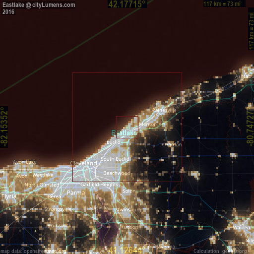
Analysis of Eastlake night lights 2016
Square area 10x10 km:
 18.51%
90-99
22.56%80-89
6.49%70-79
5.03%60-69
4.55%50-59
3.08%40-49
3.08%30-39
6.49%20-29
14.29%10-19
10.23%0-9
5.68%Square area 50x50 km:
10.92%90-99
6.8%80-89
1.94%70-79
1.88%60-69
2.39%50-59
2.58%40-49
2.89%30-39
3.26%20-29
5.96%10-19
9.25%0-9
52.12%Clear (daylight) street map image can be seen on geolist.org.
Map coordinates:
42° 10' 37.7" North, 82° 9' 12.7" West
41° 39' 14.2" North, 81° 27' 1.4" West
41° 7' 35.2" North, 80° 44' 50.2" West
Some cities around Eastlake sort by population:
• Euclid
9.3 km =5.8 mi,  223°
223°
• Mentor
9.3 km =5.8 mi,  81°
81°
• Willoughby
4 km =2.5 mi,  113°
113°
• Willowick
2.8 km =1.7 mi,  213°
213°
• Wickliffe
5.4 km =3.4 mi,  182°
182°
• Willoughby Hills
6.7 km =4.2 mi,  156°
156°
• Mentor-on-the-Lake
9.4 km =5.8 mi,  52°
52°
• Kirtland
7.9 km =4.9 mi, 110°
5152833 (p: 18,232)
Sources (retrieved 2019-11-25):
» Earth at Night: Flat Maps 2012, 2016