Wichita Falls night lights from space
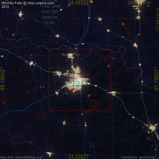
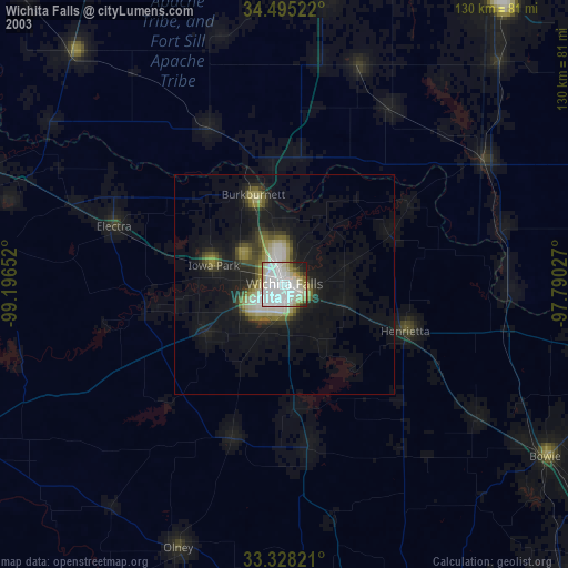
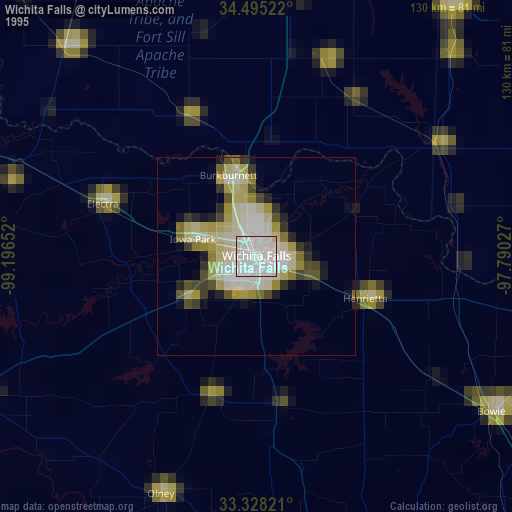
Night Light of Wichita Falls (Texas) from space (United States) Src. Average luminocity for 10x10km area is 69.5402% and for 50x50km: 8.6095%.
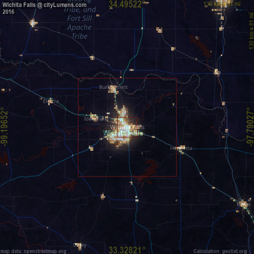
Analysis of Wichita Falls night lights 2016
Square area 10x10 km:
 15.73%
90-99
18.01%80-89
11.01%70-79
9.79%60-69
11.54%50-59
11.01%40-49
4.9%30-39
3.67%20-29
8.92%10-19
5.24%0-9
0.17%Square area 50x50 km:
1.01%90-99
1.2%80-89
1.45%70-79
1.15%60-69
1.38%50-59
1.36%40-49
0.93%30-39
1.26%20-29
2.12%10-19
4.66%0-9
83.49%Clear (daylight) street map image can be seen on geolist.org.
Map coordinates:
34° 29' 42.8" North, 99° 11' 47.5" West
33° 54' 49.4" North, 98° 29' 36.2" West
33° 19' 41.6" North, 97° 47' 25" West
Some cities around Wichita Falls sort by population:
• Lawton
77.9 km =48.4 mi,  6°
6°
• Duncan
81.9 km =50.9 mi,  36°
36°
• Burkburnett
21.7 km =13.5 mi,  340°
340°
• Vernon
76.1 km =47.3 mi,  290°
290°
• Graham
90.1 km =56 mi,  185°
185°
• Bridgeport
103.9 km =64.6 mi,  138°
138°
• Iowa Park
16.7 km =10.4 mi,  284°
284°
• Bowie
71.5 km =44.4 mi,  123°
123°
4741752 (p: 104,710)
Sources (retrieved 2019-11-25):
» NASA, Earths city lights 1995
» NASA city lights 2003
» Earth at Night: Flat Maps 2012, 2016