Westville night lights from space
Night Light of Westville (Indiana) from space (United States) Src. Average luminocity for 10x10km area is 8.4694% and for 50x50km: 13.8933%.
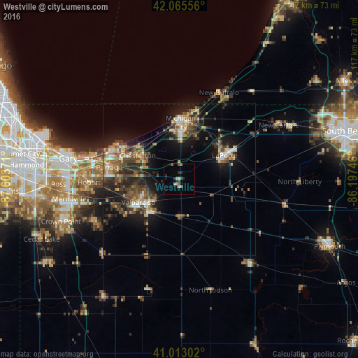
Analysis of Westville night lights 2016
Square area 10x10 km:
 0.34%
0.34%90-99
0.51%80-89
2.21%70-79
1.19%60-69
0.85%50-59
1.02%40-49
1.02%30-39
0.68%20-29
3.57%10-19
0.85%0-9
87.76%Square area 50x50 km:
1.01%90-99
1.47%80-89
1.62%70-79
1.68%60-69
1.89%50-59
2.63%40-49
3.22%30-39
3.14%20-29
4.81%10-19
10.14%0-9
68.39%Clear (daylight) street map image can be seen on geolist.org.
Map coordinates:
42° 3' 56" North, 87° 36' 13.4" West
41° 32' 29.1" North, 86° 54' 2.1" West
41° 0' 46.9" North, 86° 11' 50.9" West
Some cities around Westville sort by population:
• Portage
23.2 km =14.4 mi,  279°
279°
• Valparaiso
15.4 km =9.6 mi,  240°
240°
• Michigan City
18.5 km =11.5 mi,  1°
1°
• LaPorte
16.7 km =10.4 mi,  62°
62°
• La Porte
17.2 km =10.7 mi, 64°
• Chesterton
15.6 km =9.7 mi,  299°
299°
• Lake Station
28.4 km =17.6 mi, 277°
• South Haven
19.7 km =12.2 mi,  270°
270°
4928145 (p: 5,662)
Sources (retrieved 2019-11-25):
» Earth at Night: Flat Maps 2012, 2016