Michigan City night lights from space
Night Light of Michigan City (Indiana) from space (United States) Src. Average luminocity for 10x10km area is 47.901% and for 50x50km: 11.9524%.
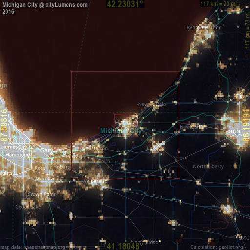
Analysis of Michigan City night lights 2016
Square area 10x10 km:
 6.17%
6.17%90-99
8.12%80-89
8.28%70-79
7.47%60-69
6.17%50-59
6.66%40-49
12.34%30-39
7.31%20-29
9.09%10-19
22.08%0-9
6.33%Square area 50x50 km:
0.8%90-99
1.18%80-89
1.37%70-79
1.52%60-69
1.7%50-59
2.28%40-49
2.84%30-39
2.75%20-29
4.12%10-19
8.12%0-9
73.32%Clear (daylight) street map image can be seen on geolist.org.
Map coordinates:
42° 13' 49.1" North, 87° 35' 53.4" West
41° 42' 27.1" North, 86° 53' 42.1" West
41° 10' 49.7" North, 86° 11' 30.9" West
Some cities around Michigan City sort by population:
• Portage
27.6 km =17.1 mi,  237°
237°
• Valparaiso
29.5 km =18.3 mi,  207°
207°
• LaPorte
17.9 km =11.1 mi,  126°
126°
• La Porte
18.7 km =11.6 mi, 126°
• Chesterton
17.7 km =11 mi,  232°
232°
• Lake Station
32.1 km =19.9 mi, 242°
• Westville
18.5 km =11.5 mi,  181°
181°
• South Haven
27.3 km =17 mi, 227°
4923531 (p: 31,459)
Sources (retrieved 2019-11-25):
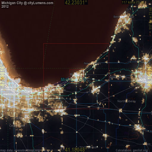
» Earth at Night: Flat Maps 2012, 2016