Westerville night lights from space
Night Light of Westerville (Ohio) from space (United States) Src. Average luminocity for 10x10km area is 87.1526% and for 50x50km: 48.3432%.
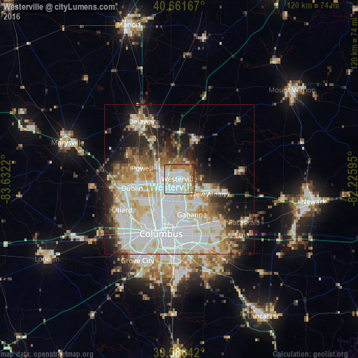
Analysis of Westerville night lights 2016
Square area 10x10 km:
 30.19%
90-99
31.98%80-89
8.93%70-79
8.77%60-69
12.5%50-59
5.19%40-49
1.79%30-39
0.32%20-29
0.32%10-19
0%0-9
0%Square area 50x50 km:
15.49%90-99
13.22%80-89
5.02%70-79
5.36%60-69
5.06%50-59
3.79%40-49
3.36%30-39
3.89%20-29
7.01%10-19
9.3%0-9
28.5%Clear (daylight) street map image can be seen on geolist.org.
Map coordinates:
40° 39' 42" North, 83° 37' 55.9" West
40° 7' 34.2" North, 82° 55' 44.7" West
39° 35' 11.1" North, 82° 13' 33.4" West
Some cities around Westerville sort by population:
• Dublin
16 km =9.9 mi,  259°
259°
• Gahanna
12.6 km =7.8 mi,  160°
160°
• Worthington
8.4 km =5.2 mi,  244°
244°
• Bexley
17.5 km =10.9 mi,  182°
182°
• Powell
12.9 km =8 mi,  285°
285°
• Lewis Center
10.6 km =6.6 mi,  319°
319°
• New Albany
11.4 km =7.1 mi,  116°
116°
• Sunbury
14.2 km =8.8 mi,  24°
24°
5176472 (p: 38,384)
Sources (retrieved 2019-11-25):
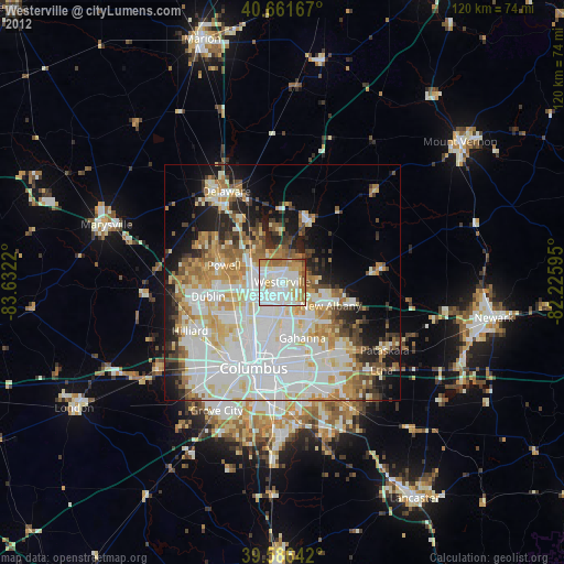
» Earth at Night: Flat Maps 2012, 2016