Powell night lights from space
Night Light of Powell (Ohio) from space (United States) Src. Average luminocity for 10x10km area is 70.2062% and for 50x50km: 42.4105%.
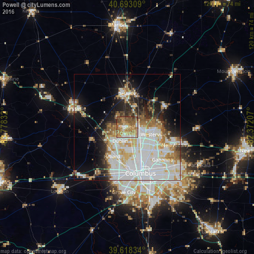
Analysis of Powell night lights 2016
Square area 10x10 km:
 8.77%
8.77%90-99
12.18%80-89
6.33%70-79
21.59%60-69
20.94%50-59
18.02%40-49
8.44%30-39
2.76%20-29
0.97%10-19
0%0-9
0%Square area 50x50 km:
13.88%90-99
11.36%80-89
4.19%70-79
4.32%60-69
4.6%50-59
3.4%40-49
2.91%30-39
3.09%20-29
5.97%10-19
9.53%0-9
36.74%Clear (daylight) street map image can be seen on geolist.org.
Map coordinates:
40° 41' 35.1" North, 83° 46' 42" West
40° 9' 28.2" North, 83° 4' 30.7" West
39° 37' 6" North, 82° 22' 19.5" West
Some cities around Powell sort by population:
• Dublin
7.3 km =4.5 mi,  206°
206°
• Westerville
12.9 km =8 mi,  105°
105°
• Delaware
15.7 km =9.8 mi,  2°
2°
• Upper Arlington
18.2 km =11.3 mi,  176°
176°
• Hilliard
15.5 km =9.6 mi, 207°
• Worthington
8.7 km =5.4 mi,  145°
145°
• Lewis Center
7.1 km =4.4 mi,  50°
50°
• Grandview Heights
20 km =12.4 mi,  171°
171°
5167350 (p: 12,972)
Sources (retrieved 2019-11-25):
» Earth at Night: Flat Maps 2012, 2016