West Valley City night lights from space
Night Light of West Valley City (Utah) from space (United States) Src. Average luminocity for 10x10km area is 88.5341% and for 50x50km: 35.5362%.
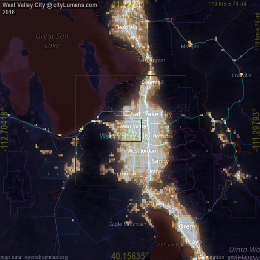
Analysis of West Valley City night lights 2016
Square area 10x10 km:
 27.44%
90-99
30.36%80-89
20.29%70-79
9.9%60-69
7.31%50-59
3.41%40-49
0.49%30-39
0.81%20-29
0%10-19
0%0-9
0%Square area 50x50 km:
9.57%90-99
9.43%80-89
5.59%70-79
3.94%60-69
4.03%50-59
3.06%40-49
2.05%30-39
2.48%20-29
5.21%10-19
8.06%0-9
46.58%Clear (daylight) street map image can be seen on geolist.org.
Map coordinates:
41° 13' 21.4" North, 112° 42' 15" West
40° 41' 29.8" North, 112° 0' 3.8" West
40° 9' 22.9" North, 111° 17' 52.5" West
Some cities around West Valley City sort by population:
• Salt Lake City
12 km =7.5 mi,  50°
50°
• Millcreek
10.6 km =6.6 mi,  92°
92°
• Taylorsville
5.9 km =3.7 mi,  116°
116°
• Murray
9.9 km =6.2 mi,  106°
106°
• Kearns
3.5 km =2.2 mi,  173°
173°
• Magna
8.7 km =5.4 mi,  282°
282°
• South Salt Lake
10 km =6.2 mi,  72°
72°
• Oquirrh
7.3 km =4.5 mi,  202°
202°
5784607 (p: 136,208)
Sources (retrieved 2019-11-25):
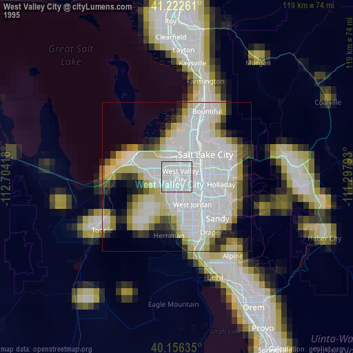
» NASA, Earths city lights 1995
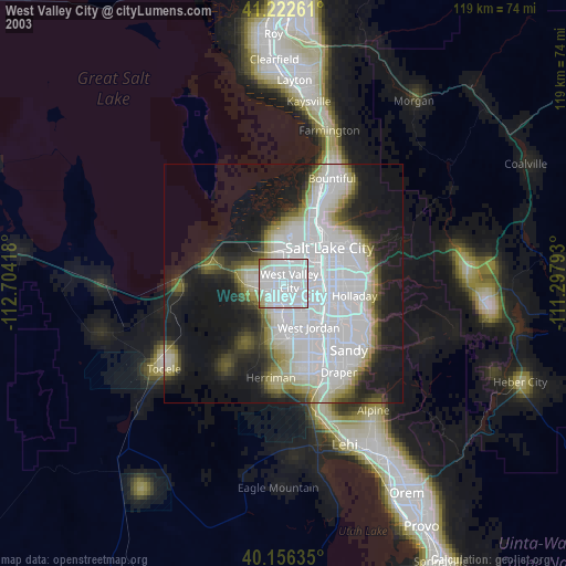
» NASA city lights 2003
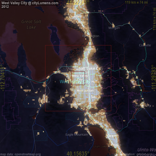
» Earth at Night: Flat Maps 2012, 2016