Murray night lights from space
Night Light of Murray (Utah) from space (United States) Src. Average luminocity for 10x10km area is 95.3231% and for 50x50km: 35.2392%.
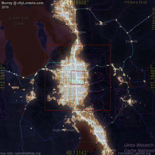
Analysis of Murray night lights 2016
Square area 10x10 km:
 41.4%
41.4%90-99
37.66%80-89
15.1%70-79
5.68%60-69
0.16%50-59
0%40-49
0%30-39
0%20-29
0%10-19
0%0-9
0%Square area 50x50 km:
9.54%90-99
9.31%80-89
5.52%70-79
3.85%60-69
3.92%50-59
3.01%40-49
2.36%30-39
2.7%20-29
5.37%10-19
7.77%0-9
46.65%Clear (daylight) street map image can be seen on geolist.org.
Map coordinates:
41° 11' 53.1" North, 112° 35' 28" West
40° 40' 0.8" North, 111° 53' 16.8" West
40° 7' 53.1" North, 111° 11' 5.5" West
Some cities around Murray sort by population:
• West Jordan
7.7 km =4.8 mi,  214°
214°
• Millcreek
2.5 km =1.6 mi,  25°
25°
• Taylorsville
4.3 km =2.7 mi,  271°
271°
• Midvale
6.3 km =3.9 mi,  189°
189°
• Holladay
5.3 km =3.3 mi,  87°
87°
• South Salt Lake
5.8 km =3.6 mi,  359°
359°
• East Millcreek
7.5 km =4.7 mi,  60°
60°
• Canyon Rim
7.1 km =4.4 mi,  51°
51°
5778755 (p: 49,250)
Sources (retrieved 2019-11-25):
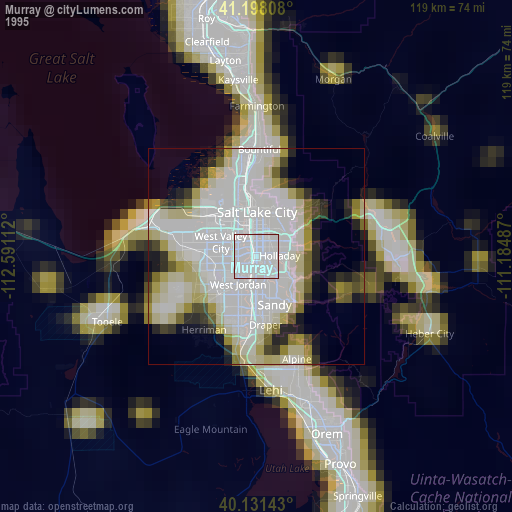
» NASA, Earths city lights 1995
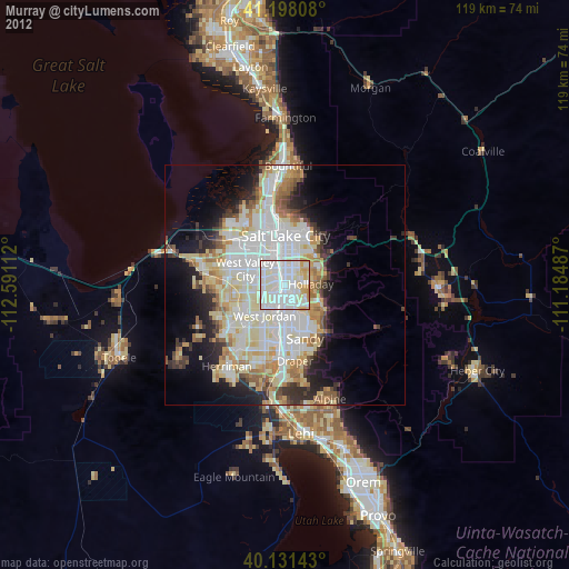
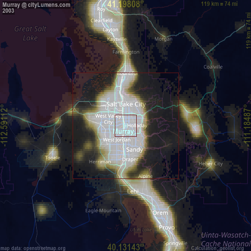
» NASA city lights 2003
» Earth at Night: Flat Maps 2012, 2016