Salt Lake City night lights from space
Night Light of Salt Lake City (Utah) from space (United States) Src. Average luminocity for 10x10km area is 91.2078% and for 50x50km: 30.5052%.
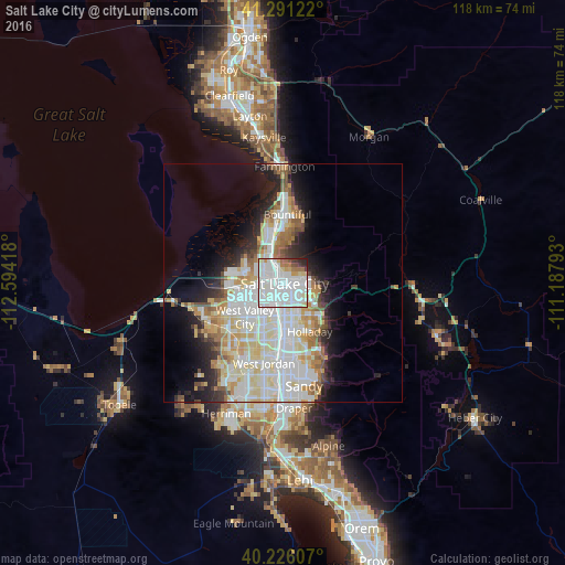
Analysis of Salt Lake City night lights 2016
Square area 10x10 km:
 48.21%
90-99
31.49%80-89
4.87%70-79
2.44%60-69
5.03%50-59
1.95%40-49
1.14%30-39
2.76%20-29
2.11%10-19
0%0-9
0%Square area 50x50 km:
8.83%90-99
8.57%80-89
4.51%70-79
3.1%60-69
2.9%50-59
2.34%40-49
1.61%30-39
2.05%20-29
4.57%10-19
7.35%0-9
54.17%Clear (daylight) street map image can be seen on geolist.org.
Map coordinates:
41° 17' 28.4" North, 112° 35' 39" West
40° 45' 38.8" North, 111° 53' 27.8" West
40° 13' 33.9" North, 111° 11' 16.5" West
Some cities around Salt Lake City sort by population:
• Millcreek
8.3 km =5.2 mi,  170°
170°
• Taylorsville
11.1 km =6.9 mi,  201°
201°
• Murray
10.4 km =6.5 mi,  178°
178°
• Holladay
11.7 km =7.3 mi,  151°
151°
• South Salt Lake
4.7 km =2.9 mi, 177°
• East Millcreek
9.6 km =6 mi,  134°
134°
• North Salt Lake
9.9 km =6.2 mi,  352°
352°
• Canyon Rim
8.4 km =5.2 mi,  135°
135°
5780993 (p: 192,672)
Sources (retrieved 2019-11-25):
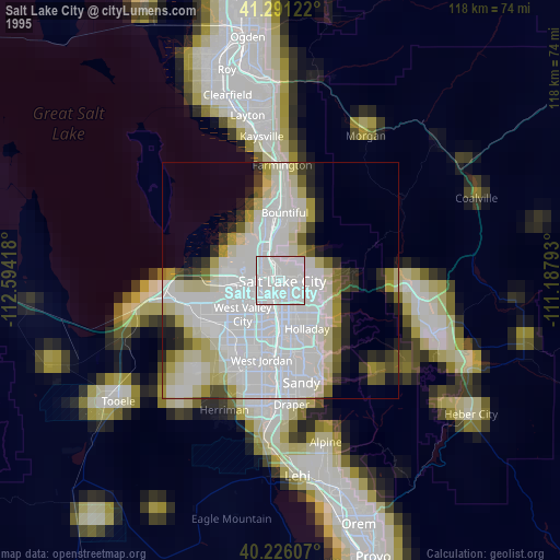
» NASA, Earths city lights 1995
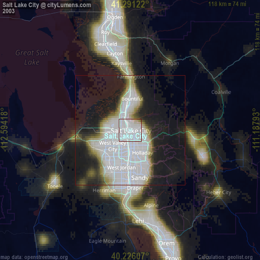
» NASA city lights 2003
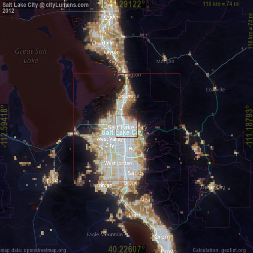
» Earth at Night: Flat Maps 2012, 2016