Millcreek night lights from space
Night Light of Millcreek (Utah) from space (United States) Src. Average luminocity for 10x10km area is 93.5633% and for 50x50km: 34.825%.
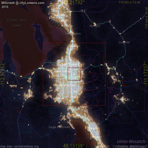

Analysis of Millcreek night lights 2016
Square area 10x10 km:
 39.94%
90-99
34.58%80-89
12.82%70-79
8.44%60-69
4.22%50-59
0%40-49
0%30-39
0%20-29
0%10-19
0%0-9
0%Square area 50x50 km:
9.55%90-99
9.36%80-89
5.43%70-79
3.82%60-69
3.91%50-59
2.79%40-49
2.12%30-39
2.5%20-29
5.29%10-19
7.54%0-9
47.69%Clear (daylight) street map image can be seen on geolist.org.
Map coordinates:
41° 13' 4.5" North, 112° 34' 43" West
40° 41' 12.8" North, 111° 52' 31.8" West
40° 9' 5.7" North, 111° 10' 20.5" West
Some cities around Millcreek sort by population:
• Salt Lake City
8.3 km =5.2 mi,  350°
350°
• Taylorsville
5.8 km =3.6 mi,  248°
248°
• Murray
2.5 km =1.6 mi,  205°
205°
• Holladay
4.7 km =2.9 mi,  115°
115°
• South Salt Lake
3.7 km =2.3 mi,  343°
343°
• East Millcreek
5.7 km =3.5 mi,  75°
75°
• Canyon Rim
5 km =3.1 mi,  64°
64°
• Mount Olympus
7.3 km =4.5 mi,  91°
91°
5778352 (p: 62,139)
Sources (retrieved 2019-11-25):
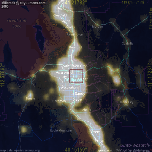
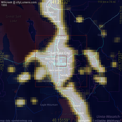
» NASA, Earths city lights 1995
» NASA city lights 2003
» Earth at Night: Flat Maps 2012, 2016