West Valley night lights from space
Night Light of West Valley (Washington) from space (United States) Src. Average luminocity for 10x10km area is 47.4318% and for 50x50km: 7.3207%.
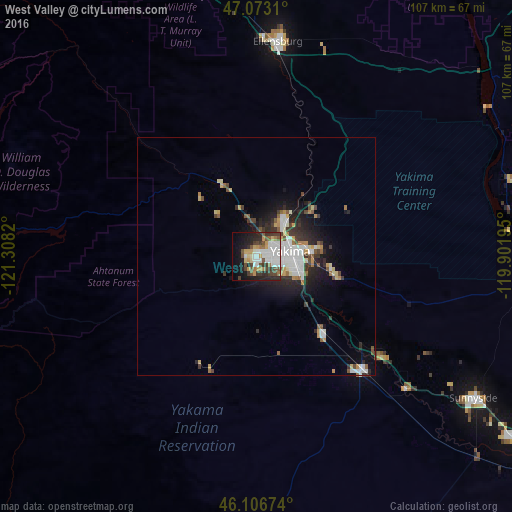
Analysis of West Valley night lights 2016
Square area 10x10 km:
 12.36%
90-99
10.09%80-89
2.98%70-79
7.24%60-69
3.69%50-59
4.4%40-49
8.81%30-39
8.52%20-29
10.8%10-19
15.91%0-9
15.2%Square area 50x50 km:
1.55%90-99
1.4%80-89
0.63%70-79
0.81%60-69
0.6%50-59
0.74%40-49
0.94%30-39
1.24%20-29
2.13%10-19
3.98%0-9
85.98%Clear (daylight) street map image can be seen on geolist.org.
Map coordinates:
47° 4' 23.2" North, 121° 18' 29.5" West
46° 35' 31.5" North, 120° 36' 18.3" West
46° 6' 24.3" North, 119° 54' 7" West
Some cities around West Valley sort by population:
• Yakima
7.7 km =4.8 mi,  81°
81°
• Ellensburg
45.2 km =28.1 mi,  5°
5°
• Sunnyside
54.6 km =33.9 mi,  123°
123°
• Toppenish
32.9 km =20.4 mi,  136°
136°
• Selah
9 km =5.6 mi,  39°
39°
• Terrace Heights
12.7 km =7.9 mi, 82°
• Union Gap
10.7 km =6.6 mi,  111°
111°
• Wapato
21.4 km =13.3 mi, 138°
5815605 (p: 12,655)
Sources (retrieved 2019-11-25):
» Earth at Night: Flat Maps 2012, 2016