Selah night lights from space
Night Light of Selah (Washington) from space (United States) Src. Average luminocity for 10x10km area is 43.973% and for 50x50km: 6.7555%.
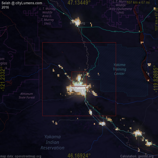
Analysis of Selah night lights 2016
Square area 10x10 km:
 10.09%
90-99
9.09%80-89
2.27%70-79
5.54%60-69
3.98%50-59
5.82%40-49
3.69%30-39
12.5%20-29
16.34%10-19
20.6%0-9
10.09%Square area 50x50 km:
1.44%90-99
1.31%80-89
0.57%70-79
0.76%60-69
0.57%50-59
0.64%40-49
0.84%30-39
1.18%20-29
2.01%10-19
3.85%0-9
86.84%Clear (daylight) street map image can be seen on geolist.org.
Map coordinates:
47° 8' 4.2" North, 121° 13' 59.5" West
46° 39' 14.5" North, 120° 31' 48.3" West
46° 10' 9.3" North, 119° 49' 37" West
Some cities around Selah sort by population:
• Yakima
6.1 km =3.8 mi,  162°
162°
• Ellensburg
38.1 km =23.7 mi,  357°
357°
• Sunnyside
54.2 km =33.7 mi,  132°
132°
• West Valley
9 km =5.6 mi,  219°
219°
• Toppenish
35.1 km =21.8 mi,  151°
151°
• Terrace Heights
8.7 km =5.4 mi, 127°
• Union Gap
11.5 km =7.1 mi, 158°
• Wapato
24.4 km =15.2 mi, 159°
5809928 (p: 7,682)
Sources (retrieved 2019-11-25):
» Earth at Night: Flat Maps 2012, 2016