Wapato night lights from space
Night Light of Wapato (Washington) from space (United States) Src. Average luminocity for 10x10km area is 6.7574% and for 50x50km: 7.0846%.
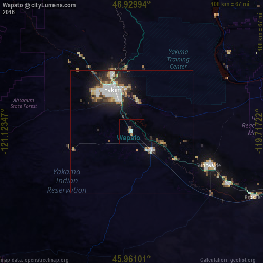
Analysis of Wapato night lights 2016
Square area 10x10 km:
 0.89%
0.89%90-99
1.49%80-89
0%70-79
1.64%60-69
0.15%50-59
1.34%40-49
0.45%30-39
0.6%20-29
0.6%10-19
1.19%0-9
91.67%Square area 50x50 km:
1.57%90-99
1.39%80-89
0.47%70-79
0.81%60-69
0.59%50-59
0.79%40-49
0.77%30-39
1.36%20-29
2.06%10-19
3.48%0-9
86.71%Clear (daylight) street map image can be seen on geolist.org.
Map coordinates:
46° 55' 47.8" North, 121° 7' 24.5" West
46° 26' 51.5" North, 120° 25' 13.2" West
45° 57' 39.6" North, 119° 43' 2" West
Some cities around Wapato sort by population:
• Yakima
18.4 km =11.4 mi,  339°
339°
• Sunnyside
34.4 km =21.4 mi,  113°
113°
• West Valley
21.4 km =13.3 mi,  318°
318°
• Grandview
45.4 km =28.2 mi,  118°
118°
• Toppenish
11.6 km =7.2 mi,  132°
132°
• Selah
24.4 km =15.2 mi, 339°
• Terrace Heights
17.7 km =11 mi,  355°
355°
• Union Gap
12.9 km =8 mi, 341°
5814992 (p: 5,068)
Sources (retrieved 2019-11-25):
» Earth at Night: Flat Maps 2012, 2016