Sunnyside night lights from space
Night Light of Sunnyside (Washington) from space (United States) Src. Average luminocity for 10x10km area is 25.0714% and for 50x50km: 3.1939%.
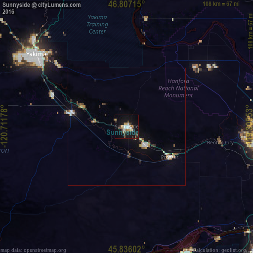
Analysis of Sunnyside night lights 2016
Square area 10x10 km:
 4.02%
4.02%90-99
4.91%80-89
1.93%70-79
3.27%60-69
1.93%50-59
2.98%40-49
2.68%30-39
3.13%20-29
2.83%10-19
32.74%0-9
39.58%Square area 50x50 km:
0.42%90-99
0.52%80-89
0.26%70-79
0.34%60-69
0.26%50-59
0.43%40-49
0.34%30-39
0.6%20-29
0.46%10-19
2.25%0-9
94.13%Clear (daylight) street map image can be seen on geolist.org.
Map coordinates:
46° 48' 25.7" North, 120° 42' 42.4" West
46° 19' 25.5" North, 120° 0' 31.1" West
45° 50' 9.7" North, 119° 18' 19.9" West
Some cities around Sunnyside sort by population:
• Yakima
49.1 km =30.5 mi,  309°
309°
• West Richland
49.8 km =30.9 mi,  92°
92°
• Grandview
11.5 km =7.1 mi,  134°
134°
• Toppenish
23.8 km =14.8 mi,  284°
284°
• Terrace Heights
45.6 km =28.3 mi, 313°
• Union Gap
44.2 km =27.5 mi, 306°
• Prosser
22.6 km =14 mi, 125°
• Wapato
34.4 km =21.4 mi,  293°
293°
5812604 (p: 16,325)
Sources (retrieved 2019-11-25):
» Earth at Night: Flat Maps 2012, 2016