Toppenish night lights from space
Night Light of Toppenish (Washington) from space (United States) Src. Average luminocity for 10x10km area is 16.0878% and for 50x50km: 5.1095%.
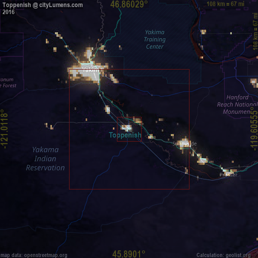
Analysis of Toppenish night lights 2016
Square area 10x10 km:
 2.83%
2.83%90-99
2.53%80-89
1.19%70-79
1.79%60-69
0.74%50-59
2.98%40-49
1.79%30-39
3.42%20-29
2.23%10-19
3.42%0-9
77.08%Square area 50x50 km:
1.08%90-99
0.97%80-89
0.36%70-79
0.56%60-69
0.39%50-59
0.59%40-49
0.57%30-39
0.81%20-29
1.24%10-19
2.85%0-9
90.58%Clear (daylight) street map image can be seen on geolist.org.
Map coordinates:
46° 51' 37" North, 121° 0' 42.5" West
46° 22' 38.5" North, 120° 18' 31.2" West
45° 53' 24.4" North, 119° 36' 20" West
Some cities around Toppenish sort by population:
• Yakima
29.2 km =18.1 mi,  328°
328°
• Sunnyside
23.8 km =14.8 mi,  104°
104°
• West Valley
32.9 km =20.4 mi,  316°
316°
• Grandview
34.3 km =21.3 mi,  114°
114°
• Selah
35.1 km =21.8 mi, 331°
• Terrace Heights
27.4 km =17 mi,  338°
338°
• Union Gap
23.7 km =14.7 mi, 327°
• Wapato
11.6 km =7.2 mi,  312°
312°
5813747 (p: 8,995)
Sources (retrieved 2019-11-25):
» Earth at Night: Flat Maps 2012, 2016