Terrace Heights night lights from space
Night Light of Terrace Heights (Washington) from space (United States) Src. Average luminocity for 10x10km area is 38.0384% and for 50x50km: 7.2876%.
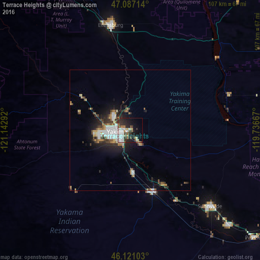
Analysis of Terrace Heights night lights 2016
Square area 10x10 km:
 9.66%
9.66%90-99
8.38%80-89
3.13%70-79
3.98%60-69
2.98%50-59
3.41%40-49
2.7%30-39
8.66%20-29
13.07%10-19
17.19%0-9
26.85%Square area 50x50 km:
1.47%90-99
1.33%80-89
0.65%70-79
0.84%60-69
0.62%50-59
0.76%40-49
0.93%30-39
1.34%20-29
2.13%10-19
4%0-9
85.94%Clear (daylight) street map image can be seen on geolist.org.
Map coordinates:
47° 5' 13.7" North, 121° 8' 34.5" West
46° 36' 22.5" North, 120° 26' 23.2" West
46° 7' 15.7" North, 119° 44' 12" West
Some cities around Terrace Heights sort by population:
• Yakima
5.1 km =3.2 mi,  264°
264°
• Ellensburg
44.2 km =27.5 mi,  349°
349°
• Sunnyside
45.6 km =28.3 mi,  133°
133°
• West Valley
12.7 km =7.9 mi, 262°
• Toppenish
27.4 km =17 mi,  158°
158°
• Selah
8.7 km =5.4 mi,  307°
307°
• Union Gap
6.1 km =3.8 mi,  206°
206°
• Wapato
17.7 km =11 mi,  175°
175°
5813249 (p: 6,937)
Sources (retrieved 2019-11-25):
» Earth at Night: Flat Maps 2012, 2016