Ellensburg night lights from space
Night Light of Ellensburg (Washington) from space (United States) Src. Average luminocity for 10x10km area is 22.7372% and for 50x50km: 1.0744%.
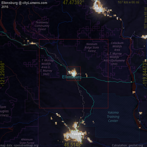
Analysis of Ellensburg night lights 2016
Square area 10x10 km:
 4.12%
4.12%90-99
4.4%80-89
1.85%70-79
3.27%60-69
3.98%50-59
0.99%40-49
1.28%30-39
1.56%20-29
1.14%10-19
25.57%0-9
51.85%Square area 50x50 km:
0.17%90-99
0.18%80-89
0.1%70-79
0.13%60-69
0.21%50-59
0.04%40-49
0.05%30-39
0.09%20-29
0.06%10-19
1.08%0-9
97.87%Clear (daylight) street map image can be seen on geolist.org.
Map coordinates:
47° 28' 26.1" North, 121° 15' 3.5" West
46° 59' 47.4" North, 120° 32' 52.3" West
46° 30' 53.3" North, 119° 50' 41" West
Some cities around Ellensburg sort by population:
• Yakima
44 km =27.3 mi,  175°
175°
• Wenatchee
50.7 km =31.5 mi,  20°
20°
• East Wenatchee
50.4 km =31.3 mi, 22°
• West Valley
45.2 km =28.1 mi,  185°
185°
• East Wenatchee Bench
51.8 km =32.2 mi, 22°
• Selah
38.1 km =23.7 mi, 177°
• Terrace Heights
44.2 km =27.5 mi,  169°
169°
• Union Gap
49.1 km =30.5 mi, 173°
5793639 (p: 19,001)
Sources (retrieved 2019-11-25):
» Earth at Night: Flat Maps 2012, 2016