West Ridge night lights from space
Night Light of West Ridge (Illinois) from space (United States) Src. Average luminocity for 10x10km area is 89.3556% and for 50x50km: 53.6991%.
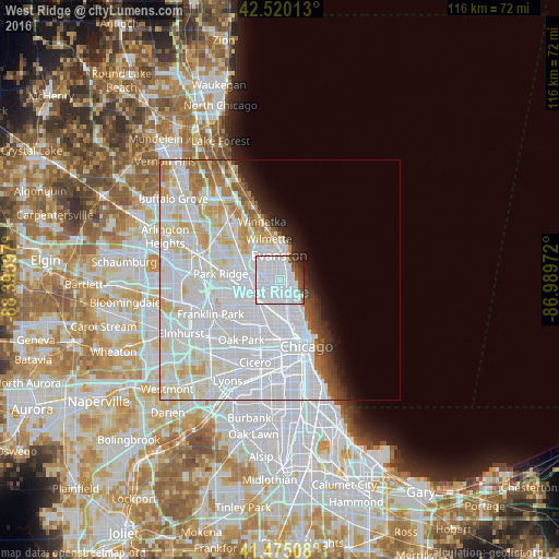
Analysis of West Ridge night lights 2016
Square area 10x10 km:
 68.57%
90-99
13.33%80-89
0%70-79
0%60-69
1.9%50-59
4.29%40-49
5.4%30-39
2.7%20-29
3.33%10-19
0.48%0-9
0%Square area 50x50 km:
29.48%90-99
13.03%80-89
5.23%70-79
2.82%60-69
2.82%50-59
1.87%40-49
1.38%30-39
1.33%20-29
1.98%10-19
3.02%0-9
37.04%Clear (daylight) street map image can be seen on geolist.org.
Map coordinates:
42° 31' 12.5" North, 88° 23' 45.5" West
41° 59' 59.1" North, 87° 41' 34.2" West
41° 28' 30.3" North, 86° 59' 23" West
Some cities around West Ridge sort by population:
• Evanston
4.6 km =2.9 mi,  2°
2°
• Skokie
5 km =3.1 mi,  318°
318°
• Uptown
5 km =3.1 mi,  138°
138°
• Edgewater
3 km =1.9 mi,  127°
127°
• Rogers Park
2.4 km =1.5 mi,  65°
65°
• Albany Park
4.3 km =2.7 mi,  215°
215°
• Lincoln Square
2.7 km =1.7 mi,  173°
173°
• Lincolnwood
3.1 km =1.9 mi,  279°
279°
4916079 (p: 72,211)
Sources (retrieved 2019-11-25):
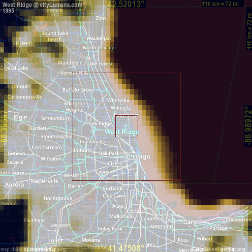
» NASA, Earths city lights 1995
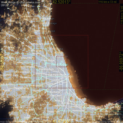
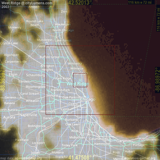
» NASA city lights 2003
» Earth at Night: Flat Maps 2012, 2016