Uptown night lights from space
Night Light of Uptown (Illinois) from space (United States) Src. Average luminocity for 10x10km area is 73.2365% and for 50x50km: 51.1562%.
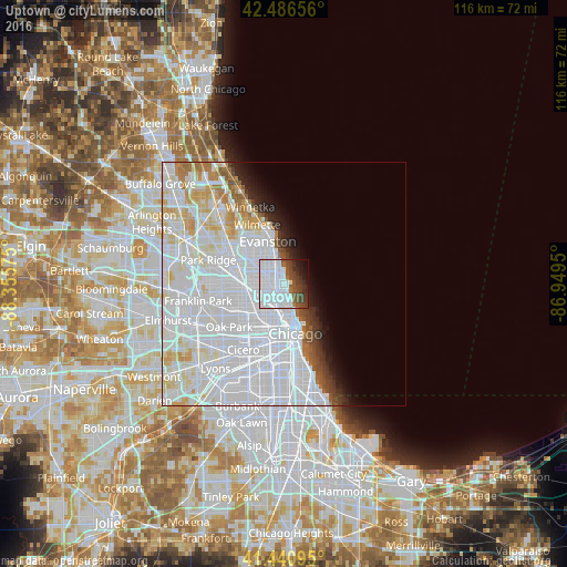
Analysis of Uptown night lights 2016
Square area 10x10 km:
 48.73%
90-99
10%80-89
0%70-79
0%60-69
3.17%50-59
6.19%40-49
9.52%30-39
7.14%20-29
6.35%10-19
6.51%0-9
2.38%Square area 50x50 km:
30.79%90-99
11.23%80-89
4.02%70-79
2.36%60-69
1.9%50-59
1.49%40-49
1.4%30-39
1.5%20-29
1.98%10-19
2.91%0-9
40.42%Clear (daylight) street map image can be seen on geolist.org.
Map coordinates:
42° 29' 11.6" North, 88° 21' 20.7" West
41° 57' 57.2" North, 87° 39' 9.4" West
41° 26' 27.4" North, 86° 56' 58.2" West
Some cities around Uptown sort by population:
• West Ridge
5 km =3.1 mi,  318°
318°
• Lincoln Park
4.9 km =3 mi,  175°
175°
• Edgewater
2.2 km =1.4 mi,  334°
334°
• Rogers Park
4.9 km =3 mi,  346°
346°
• Albany Park
5.9 km =3.7 mi,  272°
272°
• Lincoln Square
3.2 km =2 mi,  290°
290°
• Avondale
5.7 km =3.5 mi,  238°
238°
• North Center
2.6 km =1.6 mi, 238°
4914557 (p: 55,137)
Sources (retrieved 2019-11-25):
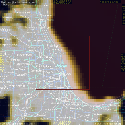
» NASA, Earths city lights 1995
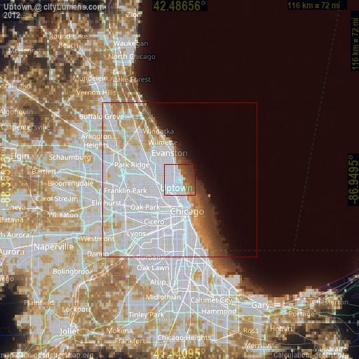
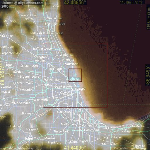
» NASA city lights 2003
» Earth at Night: Flat Maps 2012, 2016