Wayne night lights from space
Night Light of Wayne (Nebraska) from space (United States) Src. Average luminocity for 10x10km area is 8.0258% and for 50x50km: 0.8187%.
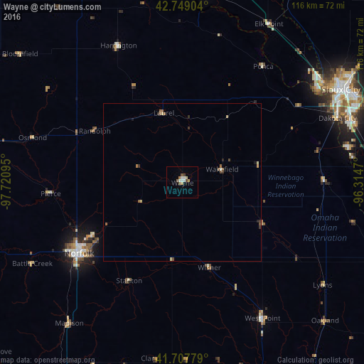
Analysis of Wayne night lights 2016
Square area 10x10 km:
 1.36%
1.36%90-99
1.67%80-89
0.61%70-79
0.91%60-69
0.91%50-59
1.52%40-49
0.91%30-39
0.61%20-29
0%10-19
0%0-9
91.52%Square area 50x50 km:
0.06%90-99
0.1%80-89
0.15%70-79
0.06%60-69
0.14%50-59
0.24%40-49
0.11%30-39
0.21%20-29
0.05%10-19
0.05%0-9
98.83%Clear (daylight) street map image can be seen on geolist.org.
Map coordinates:
42° 44' 56.5" North, 97° 43' 15.4" West
42° 13' 50" North, 97° 1' 4.2" West
41° 42' 28" North, 96° 18' 52.9" West
Some cities around Wayne sort by population:
• Sioux City
58.9 km =36.6 mi,  59°
59°
• Norfolk
39.9 km =24.8 mi,  235°
235°
• Columbus
93.7 km =58.2 mi,  198°
198°
• Yankton
77.7 km =48.3 mi,  336°
336°
• South Sioux City
56.5 km =35.1 mi, 61°
• Vermillion
61.5 km =38.2 mi,  6°
6°
• Le Mars
93.8 km =58.3 mi,  48°
48°
• Schuyler
87.2 km =54.2 mi,  182°
182°
5081454 (p: 5,569)
Sources (retrieved 2019-11-25):
» Earth at Night: Flat Maps 2012, 2016