Wayne night lights from space
Night Light of Wayne (Michigan) from space (United States) Src. Average luminocity for 10x10km area is 90.6515% and for 50x50km: 63.4998%.
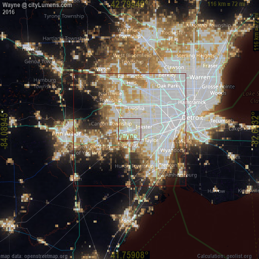
Analysis of Wayne night lights 2016
Square area 10x10 km:
 26.06%
90-99
38.94%80-89
16.97%70-79
10.91%60-69
6.52%50-59
0.61%40-49
0%30-39
0%20-29
0%10-19
0%0-9
0%Square area 50x50 km:
22.2%90-99
17.22%80-89
6.5%70-79
6.62%60-69
7.13%50-59
5.75%40-49
4.44%30-39
3.89%20-29
7.09%10-19
7.12%0-9
12.05%Clear (daylight) street map image can be seen on geolist.org.
Map coordinates:
42° 47' 58.2" North, 84° 5' 22" West
42° 16' 53.1" North, 83° 23' 10.8" West
41° 45' 32.7" North, 82° 40' 59.5" West
Some cities around Wayne sort by population:
• Livonia
10.1 km =6.3 mi,  15°
15°
• Canton
8.4 km =5.2 mi,  291°
291°
• Westland
4.9 km =3 mi,  346°
346°
• Taylor
10.6 km =6.6 mi,  115°
115°
• Dearborn Heights
11.2 km =7 mi,  56°
56°
• Garden City
6.7 km =4.2 mi,  42°
42°
• Inkster
6.4 km =4 mi,  77°
77°
• Romulus
6.6 km =4.1 mi,  187°
187°
5014224 (p: 17,081)
Sources (retrieved 2019-11-25):
» Earth at Night: Flat Maps 2012, 2016