Taylor night lights from space
Night Light of Taylor (Michigan) from space (United States) Src. Average luminocity for 10x10km area is 95.4515% and for 50x50km: 62.4788%.
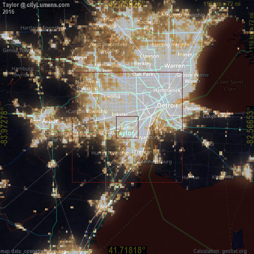
Analysis of Taylor night lights 2016
Square area 10x10 km:
 37.73%
90-99
47.42%80-89
9.7%70-79
2.27%60-69
2.73%50-59
0.15%40-49
0%30-39
0%20-29
0%10-19
0%0-9
0%Square area 50x50 km:
26.09%90-99
16%80-89
5.72%70-79
5.87%60-69
5.47%50-59
4.83%40-49
3.68%30-39
3.25%20-29
5.66%10-19
7.16%0-9
16.27%Clear (daylight) street map image can be seen on geolist.org.
Map coordinates:
42° 45' 33.3" North, 83° 58' 22" West
42° 14' 27.1" North, 83° 16' 10.7" West
41° 43' 5.4" North, 82° 33' 59.5" West
Some cities around Taylor sort by population:
• Lincoln Park
7.6 km =4.7 mi,  81°
81°
• Southgate
6.9 km =4.3 mi,  115°
115°
• Allen Park
5.2 km =3.2 mi,  68°
68°
• Wyandotte
10.3 km =6.4 mi,  106°
106°
• Inkster
6.8 km =4.2 mi,  330°
330°
• Riverview
10.5 km =6.5 mi,  134°
134°
• Melvindale
9 km =5.6 mi,  59°
59°
• Ecorse
10.2 km =6.3 mi,  87°
87°
5011908 (p: 61,568)
Sources (retrieved 2019-11-25):
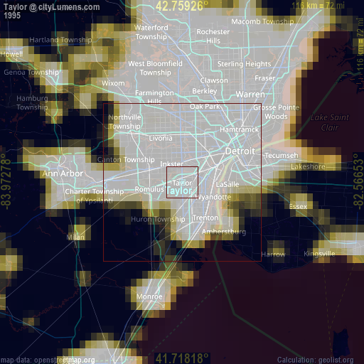
» NASA, Earths city lights 1995
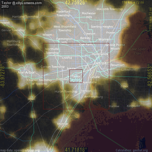
» NASA city lights 2003
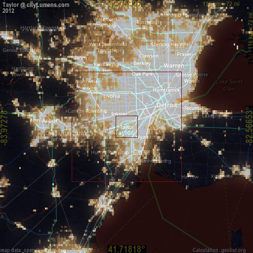
» Earth at Night: Flat Maps 2012, 2016