Canton night lights from space
Night Light of Canton (Michigan) from space (United States) Src. Average luminocity for 10x10km area is 73.403% and for 50x50km: 60.0718%.
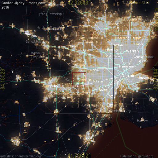
Analysis of Canton night lights 2016
Square area 10x10 km:
 10.61%
90-99
16.67%80-89
13.79%70-79
15.3%60-69
15%50-59
15.61%40-49
10.15%30-39
2.42%20-29
0.45%10-19
0%0-9
0%Square area 50x50 km:
16.28%90-99
16.84%80-89
7.18%70-79
7.41%60-69
8.88%50-59
5.92%40-49
4.67%30-39
3.68%20-29
7.24%10-19
9.18%0-9
12.73%Clear (daylight) street map image can be seen on geolist.org.
Map coordinates:
42° 49' 35.3" North, 84° 11' 7" West
42° 18' 31.1" North, 83° 28' 55.8" West
41° 47' 11.5" North, 82° 46' 44.5" West
Some cities around Canton sort by population:
• Livonia
12.5 km =7.8 mi,  58°
58°
• Westland
7 km =4.3 mi,  75°
75°
• Garden City
12.6 km =7.8 mi, 81°
• Romulus
11.9 km =7.4 mi,  143°
143°
• Ypsilanti
13.1 km =8.1 mi,  235°
235°
• Wayne
8.4 km =5.2 mi,  111°
111°
• Plymouth
7 km =4.3 mi,  8°
8°
• Northville
13.6 km =8.5 mi,  359°
359°
4987990 (p: 86,825)
Sources (retrieved 2019-11-25):
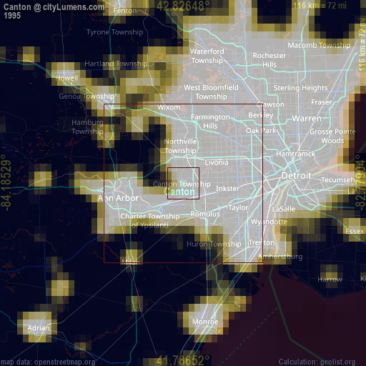
» NASA, Earths city lights 1995
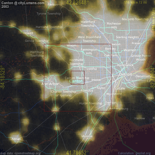
» NASA city lights 2003
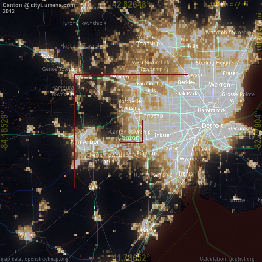
» Earth at Night: Flat Maps 2012, 2016