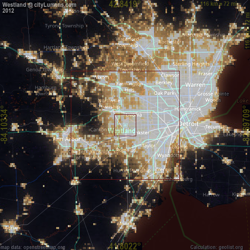
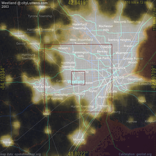
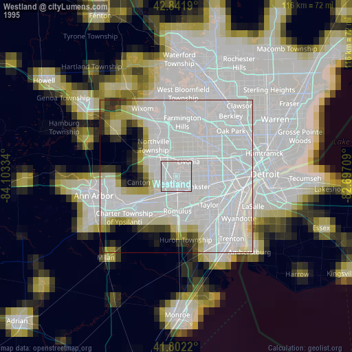
Westland night lights from space
Night Light of Westland (Michigan) from space (United States) Src. Average luminocity for 10x10km area is 91.9182% and for 50x50km: 66.8632%.
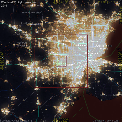
Analysis of Westland night lights 2016
Square area 10x10 km:
 25.15%
90-99
41.06%80-89
21.06%70-79
10.91%60-69
1.82%50-59
0%40-49
0%30-39
0%20-29
0%10-19
0%0-9
0%Square area 50x50 km:
22.36%90-99
18.32%80-89
7%70-79
7.27%60-69
8.95%50-59
6.27%40-49
4.38%30-39
3.68%20-29
6.85%10-19
6.93%0-9
7.99%Clear (daylight) street map image can be seen on geolist.org.
Map coordinates:
42° 50' 30.8" North, 84° 6' 12" West
42° 19' 27.1" North, 83° 24' 0.8" West
41° 48' 7.9" North, 82° 41' 49.5" West
Some cities around Westland sort by population:
• Livonia
6.3 km =3.9 mi,  38°
38°
• Canton
7 km =4.3 mi,  255°
255°
• Dearborn Heights
10.5 km =6.5 mi,  82°
82°
• Redford
10.8 km =6.7 mi,  52°
52°
• Garden City
5.7 km =3.5 mi,  88°
88°
• Inkster
8.1 km =5 mi,  114°
114°
• Wayne
4.9 km =3 mi,  166°
166°
• Plymouth
7.8 km =4.8 mi,  312°
312°
5014681 (p: 82,000)
Sources (retrieved 2019-11-25):
» NASA, Earths city lights 1995
» NASA city lights 2003
» Earth at Night: Flat Maps 2012, 2016