Washington night lights from space
Night Light of Washington (Iowa) from space (United States) Src. Average luminocity for 10x10km area is 12.1071% and for 50x50km: 1.3454%.
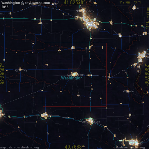
Analysis of Washington night lights 2016
Square area 10x10 km:
 0.32%
0.32%90-99
0.81%80-89
3.57%70-79
3.73%60-69
0.16%50-59
1.14%40-49
1.79%30-39
1.3%20-29
1.46%10-19
0.65%0-9
85.06%Square area 50x50 km:
0.01%90-99
0.06%80-89
0.42%70-79
0.24%60-69
0.21%50-59
0.26%40-49
0.19%30-39
0.16%20-29
0.31%10-19
0.1%0-9
98.03%Clear (daylight) street map image can be seen on geolist.org.
Map coordinates:
41° 49' 31" North, 92° 23' 45.9" West
41° 17' 57" North, 91° 41' 34.6" West
40° 46' 7.7" North, 90° 59' 23.4" West
Some cities around Washington sort by population:
• Iowa City
42.5 km =26.4 mi,  18°
18°
• Burlington
73.2 km =45.5 mi,  138°
138°
• Ottumwa
67.7 km =42.1 mi,  242°
242°
• Muscatine
56 km =34.8 mi,  75°
75°
• Coralville
43 km =26.7 mi,  12°
12°
• North Liberty
50.7 km =31.5 mi, 8°
• Fairfield
39.4 km =24.5 mi,  214°
214°
• Mount Pleasant
39 km =24.2 mi,  163°
163°
4880731 (p: 7,408)
Sources (retrieved 2019-11-25):
» Earth at Night: Flat Maps 2012, 2016